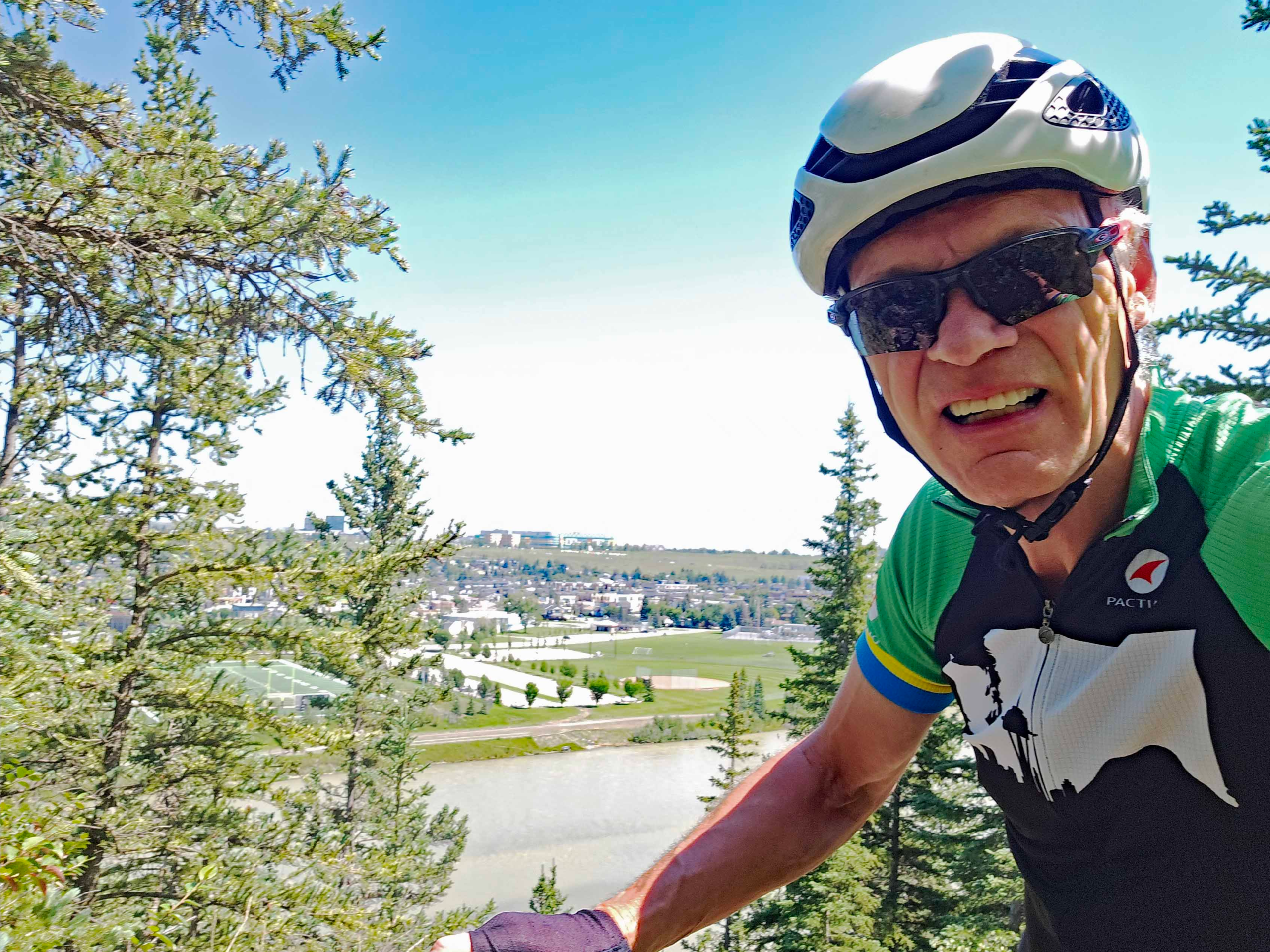
My very first ride recorded on the activity app Strava was a lunchtime circuit with a work colleague over ten years ago. My friend Steve introduced me to the app that had been around for five years at that point. Initially I used the free version on my iphone and then later integrated it so that it automatically uploaded rides from my Garmin 520 cycle computer. Soon all my exercise activities were going on Strava and I upgraded to the subscription version that gave more detailed analysis of your activities like power curves and heart rate zones. I was never particularly interested in the “Segments” features where someone records their time over a specific stretch of road and then others try to go faster.
My First Stava Ride in 2015
Ten years later and this “Segments” feature appears to be the core of a patent argument between former allies. In the early days, Strava may have been in awe of its major hardware partner Garmin but times have changed. Strava now boasts over 120 million users world-wide, and tech companies like Apple and Wahoo are challenging Garmin’s dominance in activity- monitoring hardware. Unable to resolve its differences with Garmin, Strava has taken the drastic step of suing it biggest business partner. To those of us uneducated with the details of the patent wrangle it all seems like so much corporate posturing. A great analysis of the legal arguments is given by DC Rainmaker here: Strava Just Sued Garmin: Demands Garmin Stop Selling Devices | DC Rainmaker.
Whatever the outcome of the legal battle, those of us who use both Garmin hardware and the Strava social media app are likely to be losers in the long term. While Garmin does have its own software for presenting results, I don’t know anyone who uses it as the go-to app has been Strava, that up to now has been hardware-agnostic. I have 2,400 separate activities recorded on Strava, 1,800 of which are bike rides, including my 2022 ride across Canada. In that year, I was in the top 2% of Strava uses worldwide.
I have a great fondness for Strava and look at the activities of fifty or so people I follow every morning over my breakfast cereal. We inspire and inform each other and, with local riders, give each other ideas for different routes and challenges. I have virtual friends in countries like Germany, UK, Holland, Brazil and Mexico that I follow vicariously as well as friends in Calgary that I occasionally ride with in real life. I will sorely miss this community if the rift with Garmin ruptures the data link.
Relying on Garmin handheld GPS for Geocaching in remote areas
Similarly, I have long been a fan of Garmin equipment from my very first GPS back in 2002 just after satellite positioning became available to the general public. Since then, I relied on handheld GPS when navigating in the mountains of British Columbia as a member of a search and rescue team and when hiking alone. As a family we used Garmin’s for Geocaching and as a motorist I have always had a Garmin car GPS system.
Garmin 530 I use for all cycling adventures
I am torn between my loyalties to both companies. It’s rather like being the friend of a couple divorcing when you love both equally but know at some point you will be forced to favour one or the other more. Strava has the ability to issue a software upgrade at any time that would exclude Garmin-derived activities from their database but whether they would take this irrevocable step is anyone’s guess.
I could continue to use Strava with Zwift and with my training program app Trainer Road for indoor activities and even on my Samsung Cell phone for outdoor activities but I would certainly be conflicted and inconvenienced.
Let’s just hope that common sense will prevails and egos can be put aside to resolve this dispute, if not amicably, then not to the detriment of either user base.
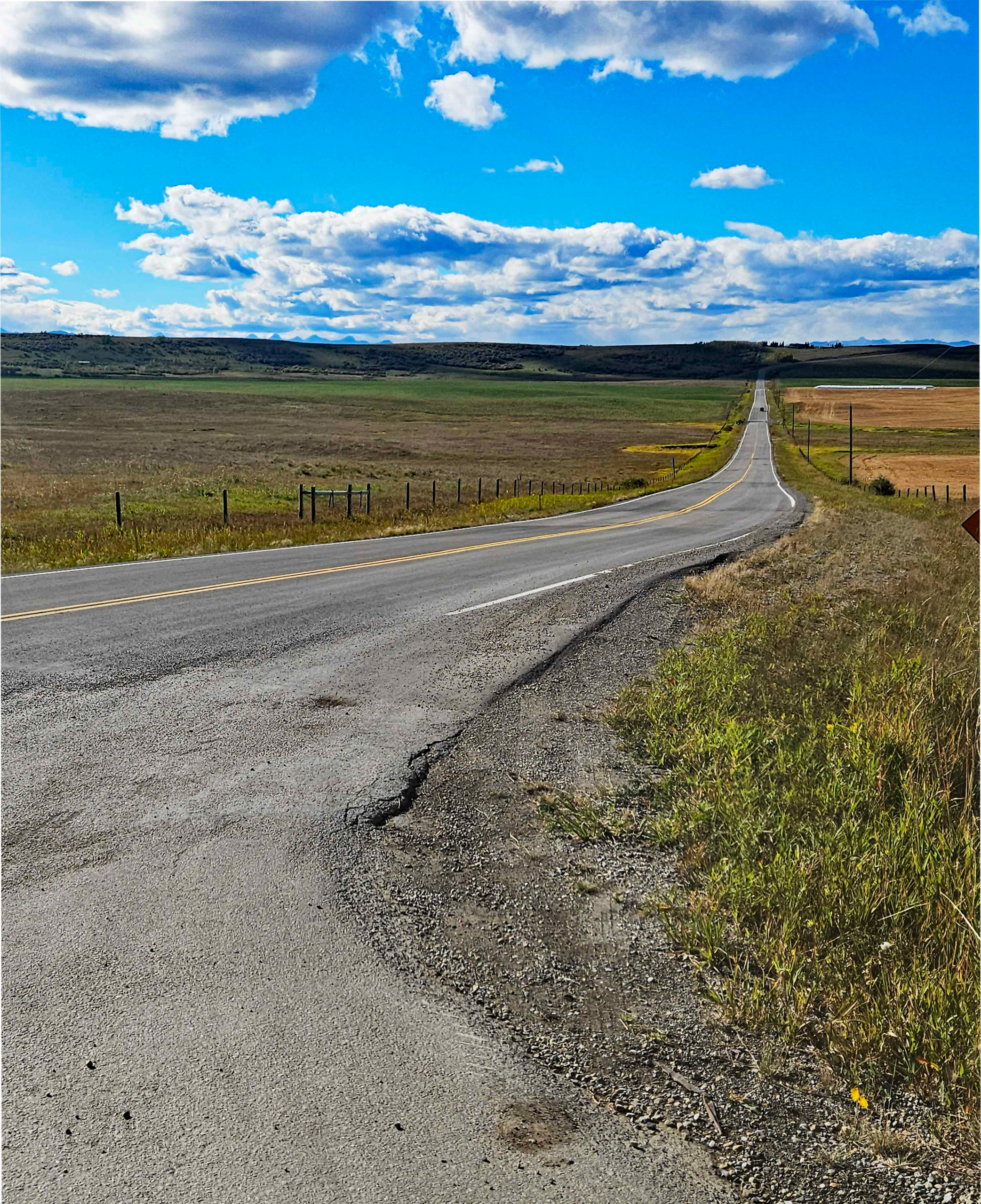
Cochrane is a great destination for a bike ride as there are numerous routes to get there and back. From Downtown, the shortest return journey will be almost 100km but this can be halved by starting out from Shane Homes Rocky Ridge YMCA north of Tuscany. For gravel lovers, there are some unpaved roads south of the Bow River running north of Springbank Airport and the Harmony development, or a there is a short section at the eastern terminus of Glenbow Park on the north side of the river. Timewise, your choices range from a 2-hour sprint to a leisurely 5-hour meander. Fortunately, there are several cafes in Cochrane like the Good Earth Coffeehouse at the Quarry where you can take a mid-ride break, especially if you are braving colder weather.
If you were driving to Cochrane from either Downtown or Northwest Calgary, you would opt for the Crowchild Trail, Highway 1A. But Highway 1A is not a choice for cycling out of Downtown, even though it is a legal option. Heavy, fast-moving traffic and multiple on and off ramps make this an unsafe choice, particularly when there are bike trail alternatives. Outside the city boundary west of Tuscany, the road settles down to a steady 4-lane highway with a wide shoulder. For cyclists comfortable with fast moving traffic on their left, this is an option all the way to Cochrane but care needs to be taken if you descend into Cochrane on the highway as you will need to cross lanes to make a left turn into the town at some point. Alternatively, you can turn left at the top of the hill and ride down on the quieter Gleaneagles Drive.
Potential Cycle Routes to Cochrane
Starting from the YMCA, you can avoid Highway 1A highway completely by following parallel roads and then just cross the 1A at the traffic lights at the top of Cochrane Hill. If you don’t want to climb back up Cochrane Hill from the low point in the town, just turn around at the Highway 1A intersection. This is a favourite evening ride for bike clubs as the return distance is 50 km, easily rideable in 2 hours in an organized group.
There are several ways to reach the YMCA from downtown but my recommendation would be to follow the Bow River Pathway. You can take either the north or south bank of the river on the Pathway but while the flood bank work is being conducted in Sunnyside and Kensington the south side works best. No further west than the Crowchild Trail crossing, you too will need to cross to the north bank as the path to Edworthy Park on the south side is either closed in winter and spring, or closed for repair work. Once the frost- and root-heaved paving is eventually replaced, this may be a good summer/fall alternative again as the wooded scenery makes a pleasant change from the urban scenery of Parkdale.
Township Road 262 in the Spring
Once through Shouldice Park, you cross the old railway bridge and follow the Bowness Road through Bowness. Car traffic is well-behaved here and although the bike lane is alongside the road, the bike path always feels safe. Bowness Road swings north and turns into 85 Street that takes you past the iconic Angels Burger restaurant and then you can either turn left at 48 Ave for Bowness Park and cross the river at the west end, or continue over the river and turn left into Baker Park. Your objective is the cycle path that climbs up parallel to the Stoney Trail towards the Tuscany C-Train station.
An alternative route when leaving Shouldice Park is to stay north of the river, climb up 52 Street to Dale Hodges Park and Bowmont Park and then drop down through Baker Park to reach the bike trail on the west side of the Stoney Trail highway. This route is longer and involves climbing a steep hill.
Scenic route through Glenbow Ranch on the north bank of the Bow River
The bike trail parallel to the Stoney Trail highway wends its way up to Tuscany Station where I usually continue up Rocky Ridge Road, past the Mormon Temple to cross Country Hills Boulevard and arrive at the Rocky Ridge YMCA. At this point, you will have cycled 25km and climbed 280metres. There’s no need to include the YMCA if you head more northwesterly from the Tuscany Station and enter Bearspaw where 12 Mile Coulee and Country Hills Boulevard meet.
There are several ways to wiggle through the park-like estates at Bearspaw but eventually you will need to take Township Road 262 to the west. You can extend the ride to Cochrane by continuing north on Bearspaw Road as far as Big Hill Springs Road before turning west. Be aware though that Big Hill Springs Road is the Highway 567 link road from Airdrie. This route has freight traffic bound for the Cowboy Trail, Highway 22, the main north-south road into Cochrane. Also, Big Hill Springs Road has little to no shoulder.
Big Hill Springs Rd headed west (Highway 567) with narrow shoulder
The joy with taking this route, though, is that west of the Cowboy Trail you are on quiet country roads and can join up with Horse Creek Road and approach Cochrane from the northwest down the scenic Horse Creek valley. Eventually you join up with the Glen Bole’s Trail that leads you alongside the Bow River and into town. The additional loop adds another 20km to the outbound journey.
South of the Bow River, motorists headed for Cochrane have the option of taking the Trans- Canada Highway, Highway 1 as far west as the Cowboy Trail and then turning north to Cochrane. The Trans-Canada is not a great choice for cyclists, again because of the volume and speed of traffic so you need to consider parallel alternatives. Also, there are no routes out of town between the Trans Canada and the Bow River so, initially, you will need to stay south of Highway 1 or cross the Highway further west.
I have tried four routes, the first climbs out of the Bow Valley on the Quarry Trail under Shaganappi Golf Course. This route follows quiet residential roads and eventually bike paths by the Bow Trail through Strathcona and Wentworth. The route finally exits west on Springbank Road, the Old Banff Coach Road but it is slow with many turns and road crossings and is not one I would recommend. Another route connects up to the Old Banff Coach Road from Edworthy Park but has the same problems as the first route.
The two options I would suggest for a route on the south side of the Bow River involve passing through Bowness and Crestmont. The most direct leaves Bowness up 83 Street and takes the Highway 1 overpass to the Canada Olympic Park. Exit at the west side of the Park onto Crestmont Boulevard and climb up to Crestmont. The other way to Crestmont is to continue onto Bowness Park from Bowness and to climb up the zig-zags under the Stoney Trail bridge.
Facing the climb up the Zig-Zags under the Stoney Trail at Bowness Park
From Crestmont, you can take the Old Banff Coach Road back over Highway 1 and then ride west past Springbank Airport on Township Road 250, or stay south of the Trans Canada by opting for Township Road 245. This southerly route involves a 300m connector of downhill gravel where care is needed and you will still need to turn north at Calaway amusement park to join Township Road 250. Had you exited the city on Springbank Road, you could have kept riding west until you intersected the Cowboy Trail or turn north past Calaway Park to join Township Road 250.
All westerly roads eventually intersect the Cowboy Trail which you then have to follow north to drop down into Cochrane. The Cowboy Trail is a busy, fast road but has a reasonable shoulder though the only footpath over the Bow River bridge is on the northbound (east) side. The only way of avoiding any riding by the Cowboy Tail still involves crossing the Cowboy Trail to follow a long, looping route to the west with gravel on the Tower Trail.
If you intend to ride gravel to Cochrane, then another parallel route from Crestmont takes you even further north of the Trans-Canada, conveys you behind all the new development at Harmony and the Springbank Airport and brings you out at the Cowboy Trail just before the Cowboy Trails drops down to the Bow River Crossing. A quieter gravel road crosses the river 2km downstream of the Cowboy Trail bridge on the old River Avenue Bridge.
Bearspaw Park from Woodward Road in the Fall
Whichever way you ride out to Cochrane, theres no need to reverse this for the return as you can use one of the other options. The shorter the route selected though the fewer the number of alternatives for returning. However, there should be a choice for everyone, no matter how unsure you are of motor traffic.
When I read an article in the spring edition of Bicycling Magazine about a missing mountain biker in Wyoming who had never been found, The Unsolved Case of a Missing Mountain Biker in Wyoming my interest as a long time Search and Rescue volunteer and cyclist was piqued. I had taken part in over 100 searches, including 5 where the subjects were never found. However, in the mountains of British Columbia, we had always found missing mountain bikers.
Looking further afield in Canada, I came across the strange case of Marty Leger, a 30-year old mountain biker who had disappeared after going for an afternoon ride in wild country near Halifax, Nova Scotia at end of May in 2014; 11 years later and he has not been found. The mysterious disappearance of cyclist Marty Leger in Nova Scotia — StrangeOutdoors.com From my experience, lost mountain bikers tended to be on or near trails, they didn’t just go wandering off through the bush as a hiker might. For a start it is impractical to haul a 30lb mountain bike through dense scrub. If he had abandoned his new Santa Cruz Heckler to head off through the bush, then why wasn’t the bike found either?
Superficially, the Wyoming and the Nova Scotia cases were similar but there were significant differences in the circumstances of each which made Marty Leger’s disappearance even more mysterious. Nash Quinn, in Laramie , Wyoming had had little contact with friends or family at the time of his disappearance so it was 12 days before police carried out a wellness check and found his car, phone and wallet at his home. His bike, helmet and cycling shoes were absent.
Location of Laramie in Wyoming
Wyoming is the least populated State in the United States and as no-one knew where Nash had gone the potential search area in the wilderness around Laramie was immense. A friend who had ridden with Nash in the past suggested potential biking areas and searchers eventually zeroed in on one area based on what Nash had been reviewing previously on his cell phone. However, there was no sign of him or his white bike and the search was suspended.
Location of Spider lake bike trail system in Nova Scotia
In Nova Scotia, Marty had only disappeared for an afternoon when he was reported missing the same evening. He was intending to ride for a couple of hours after work before going home to Halifax. His vehicle was found at the biking trailhead that evening. While he had left his trail map in his vehicle at the trailhead, there is cell phone cover for the area between Highway 118 and Spider Lake.
Bike trails shown on Trailforks for the Spider Lake area
The Trail Forks app shows 17 trails sandwiched between the highway, Spider Lake and Leonard Lake in a roughly rectangular area 5km x2km. Five of the trails are rated moderate and the rest are easier. The terrain is rugged but varies in height by less than 100m and the total distance of all the trails is 19km. A search and rescue team with 20 members would have been able to walk the whole system in 3 hours but that initial search of the trails revealed nothing.
Having covered all the immediate trails, the team were perplexed. Did he ride outside the trail system or was he off trail but still in the area? They would have looked down slopes into areas he may have fallen off the trail during their rapid search so now they had to expand the overall area and conduct a grid search in the immediate trail area. A grid search is a tedious search technique that covers all the terrain between trails with searchers spaced apart in a line but close enough to see each other and, more importantly, to spot an inert person or bike. Marty’s Heckler bike was black so not an easy colour to spot in the shade of a forest.
The search for Marty involved several hundred people including army personnel
The search continued from for 29 May to Jun 4, eventually involving hundreds of searchers including the Army. A helicopter was also employed, but over forest this would have been ineffective unless Marty was able to attract the crew’s attention or they employed heat sensors. As in Nash Quinn’s case, not a single clue associated with Marty was found. A witness later confirmed seeing him on the trail that afternoon but that was the last time anyone had seen him.
A poignant memorial was set up near the Spider Lake trailhead
Two years later, the body of a man was found by a hunter in brush only a kilometre from the trailhead but it was not Marty. This person had disappeared a year before Marty and probably hidden himself away not intending to return. Even so, the massive search that had been centred on the trailhead had still missed this second person proving just how difficult the terrain was to search cpmpletely. But what of his bike? True it was black and hard to see in woodland but it was durable and over 5 feet in length and 3 feet high.
Having failed to find him or his bike on the trails or with a grid search, what could the search managers do? Rationally, there were only two explanations for his disappearance; either it was accidental or deliberate. In most of the searches, I was involved in, the subject was lost or injured accidentally. Where an individual intentionally aimed not to come back, they were invariably found, if not by organized searchers, by members of the public later. In Marty’s case there was no evidence he didn’t intend to go home that evening. So, he either had a sudden catastrophic accident or another party was involved.
In the 5 cases I was involved where the subjects were never found, 3 were likely accidents but two had unusual circumstances that hinted at the involvement of others. In Marty’s case, a local mountain biker had claimed that in places the trails disgorged onto logging roads that were frequented by fast-travelling pickup trucks taking revellers into the backcountry. This biker speculated a cyclist could easily be hit by a truck, and what if the driver had no intention of reporting the accident?
Other locals have mentioned the plethora of abandoned mine openings in the area from earlier gold speculators. Nowadays, the known pits are fenced off and or signed to avoid accidents, particularly those near trails. This pod cast video gives a good idea of the issue in this exact area. https://youtu.be/N6-c324wUss?si=_fNER2ylF9iS9buz Had Marty blundered into an unknown mine entrance? He certainly could have disappeared with his cycle and not been found if this was so.
When all the facts are considered, Marty’s disappearance is far more puzzling than that of Nash in Wyoming. This makes it even harder for his family to accept his loss and so, eleven years later, they are still no nearer to closure. Just how can you disappear forever on an afternoon bike ride?
I had been planning to ride this route for some time and yet it was autumn before I was ready to head out to the Kananaskis again. Looking at the elevation I would be climbing to, I was mindful of the potential for overnight frost at this time of year, even if the day time temperature in the mountains reached 20⁰C. Luckily, a stable period of warm, dry weather appeared just when I needed it.
The start at Forgetmenot Pond
The route, from what I read on line, appeared to be more suitable for a mountain bike. People had ridden it on a gravel bike and mentioned that the single-track Big Elbow Trail was rougher than the Little Elbow Trail which was double track and even drivable in a four-wheel drive vehicle with adequate clearance. Note though that the trail is closed to public motor vehicle access at all times. I was more interested in the gradients as I knew my limit was around 13%, less if the surface was particularly loose or rocky.
Trail at Little Elbow Campground
Essentially, the circuit comprises a climb from 1600m to 2200 metres to reach a wide-open saddle area between the Little and Big Elbow Rivers and then a drop back down again to the start. The steepest continuous section was between the junction of the two trails and the saddle, though this was double track. I opted to ride the loop in an anticlockwise direction, tackling the steady climb up the Little Elbow Trail first, then descending the steeper double track to the start of the Big Elbow Trail. As it would be more technical, I was happier to be going down the Big Elbow trail. On a gravel bike, I couldn’t afford to run too fast on any downhill stretch as I had no suspension and on 45mm tires.
That Friday morning dawned bright and the drive up the Elbow River from Calgary to the Forgetmenot Pond, where Highway 66 runs out, took just over an hour. As I was well inside the Kananaskis Park area, I had to buy a $15 on-line day pass beforehand. Although it was only 8:40am, two cars were parked up already. My car thermometer indicated it was only 6⁰C which felt cool so I decided to keep on a short-sleeved shirt under my Gore cycling jacket and to wear full-finger gloves. The temperature was predicted to rise quickly and it would take me two hours to climb to 2200m but I still couldn’t envisage myself overheating.
A decent double track trail
My Checkpoint bike has an internal store for an emergency tube, air cylinder and tire plugs in the fattened downtube but I carried a second spare tube and gas cylinder in the top tube bag. This still gave me space for three energy bars, a gel and chewy sweets. As an extra treat, I’d made up a cheese sandwich that was stowed in my rear jacket pocket alongside and newly- purchased cannister of bear spray. As I would be cycling solo on a single-track trail in the High Rockies, I thought this would be a wise additional precaution.
With the route set on my cycle head unit, I meandered off through the parking lot in search of a trailhead, riding against the one-way system in the Little Elbow Campground that like all the other campgrounds were closed on 14 Sep. This hadn’t stopped a couple of bike campers from pitching a tent in the campground on a stand right next to the trail. I didn’t know until later that they weren’t supposed to be there but it may explain their cagey behavior as I rode past them. Riding the route after the official campground closure may have, fortuitously reduced the number of other trail users though I passed two women hikers right near that start.
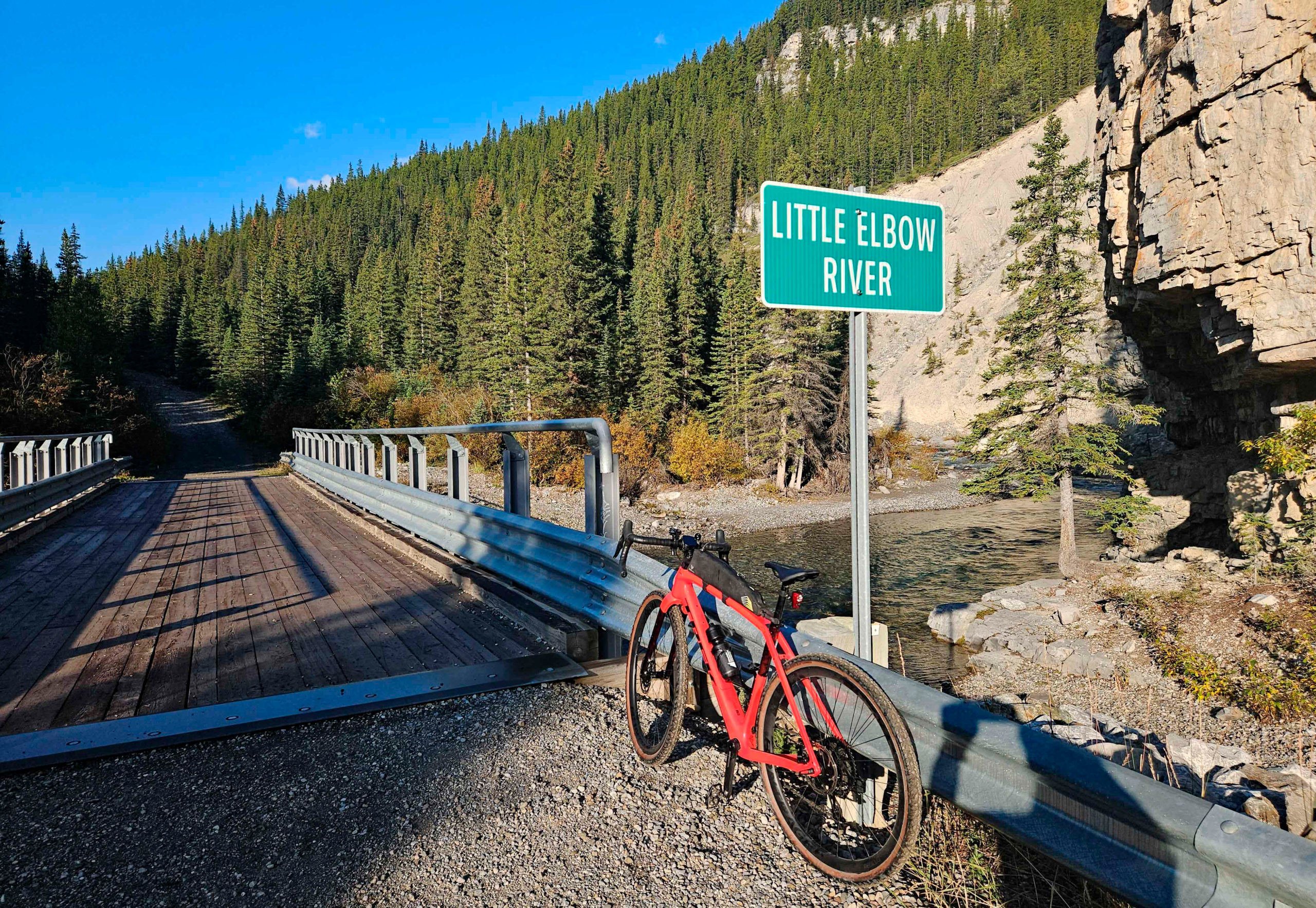
Eventually, I deduced I was on the right trail when I reached a footbridge crossing over the Little Elbow River to the Big Elbow Trail. Two more backpackers were headed in that direction while I continued on the Little Elbow Trail. Looking westwards, I had a clear view of grey-capped mountains that I would be circumnavigating; they still appeared to be a fair way off. Some of the deciduous trees in the near valley had already turned a bright yellow that contrasted with the dark evergreens.
As I had read, the gravel trail was relatively smooth and fast, only the gradient slowed me up. Not that the trail climbed continuously as there were several dips and steeper climbs where now-dry streams cut across my path. The trail continued slowly upward but the first distinctive feature was a bridge over the Little Elbow River about 4km from the trailhead. Built for vehicles, this bridge dispelled any myth that this was wilderness hiking path even though there was no public vehicle access. It was not the sort of trail I would have chosen for hiking in the mountains.
View up the Little Elbow Valley
I continued heading southwest, admiring views up the river where it wended from one valley side to the other. None of the short ramps up to this point had been noticeably long or steep until I passed the Mount Romulus wilderness campground. A wide gully crosses the trail here that was presumably feed by meltwater from the back of Mount Cornwall. In late summer, though the gully was a bone-dry dip of rubble. Fortunately, sufficient foot- and wheeled-traffic had tamped the rubble down so it was possible to cycle across. Beyond the gully was the first real challenge with a longer ramp at 13% gradient.
Start of the steeper climb with an initial ramp of 12%
After the gradient had dropped to something gentler, I was irritated to hear the sound of a motor vehicle slowly grinding its way up the hill behind me. At the top of a rise, I pulled over to let it by and, as I suspected on this closed road, it was an Alberta Parks pickup truck. The driver, an outdoors-looking guy of my age with a weather-beaten face, let me know another pickup was half an hour behind him. I had no intention of still being on the Little Elbow Trail by then.
Trailhead for Tombstone Lakes with Tombstone Mountain behind
The trail continued both to climb and to swing to the south while the long, grey ridge of Tombstone Mountain appeared on my right across the Little Elbow Valley. Meanwhile, the trail climbed higher above the level of the river. A footpath branched off the trail and dropped down to Tombstone Lakes but a sign warned no, camping, no fires and no bikes.
Saddle between Little Elbow River and Big Elbow River at 2200m
Gradually, my trail began to level out in an open, U-shaped valley with coarse brown grass and stunted evergreen shrubs. The views southwards stretched on forever where the broad saddle dropped down to the Big Elbow River. My head unit indicated I was only 3km from the junction with the Big Elbow Trail so I was content to let the speed build up initially. When the gradient increased to over 12%, I was continually pulling on the brakes, so much so that my hands started to ache. Consequently, I was happy to slow and stop for a short chat with a bearded guy porting a 50lb backpack. He mentioned he hadn’t seen any bears and that was headed for a campsite I’d not heard of.
Looking back up the descent from saddle
Continuing downhill, I was relieved when the signpost for the Big Elbow Trail appeared and I could stop braking. The ride up to that point had taken me two hours and even though it wasn’t quite 11am, I ate half my lunch sandwich. I realized then the circuit was not going to take the five hours I’d anticipated. Mistakenly, though, I imagined getting back to the start from that point in under an hour.
Split from the wide Little Elbow Trail to the single track of the Big Elbow Trail ( to left)
There’s a short rise up at the start of the Big Elbow Trail, that I assumed was the “fearsome ramp” described by other riders. Even though it was single-track, the trail was deceptively smooth at this point. Very quickly, though the descent became steeper, more technical and strewn with grapefruit-sized rocks. Where dry streams crossed, the rocks in the beds often made the route un-cyclable on a gravel bike.
Typical single track on the Big Elbow Trail and
As I rounded one corner, I startled a dark-coloured Spruce Grouse that was rooting around shrubs and had no intention of moving very far out of my way. It was the only wildlife I came across on the whole ride, confirming to me that this route was a heavily-travelled trail.
About 3km along the Big Elbow Trail, I had to walk up the steep, rubbly slope that appeared immediately after a drop down into a gully. Above me I could hear people talking and, as I reached the crest, I found myself among six mountain bikers. Some of their bikes were electric and one of the riders was wearing a downhill biker’s helmet. There were impressed to see I was on a gravel bike with no suspension although they did think assume it was electric.
Tricky descent with loose rocks and steep drop-off
Immediately beyond the mountain bike group, the route descended a steep slope flanked by and even steeper drop down to the river on my right. With rocks on the narrow path and the steep gradient, I found this part too dodgy to ride. The wheel would skid out if I kept the back brake on but the bike would run too fast into rocks if I let it run. Dismounting though was tricky too and I almost fell down the slope on the right. This wouldn’t be the only descent I had to walk down on this trail and I was beginning to ponder the wisdom of using the gravel bike. The whole time while descending this part of the trail, my shoulders and arms were tensed up and . I sensed my pulse quickened. The going was very slow even though I was travelling downhill.
Unrideable stream beds to cross on foot
Seven kilometres from the junction, I came to a footbridge over the Big Elbow that was followed by some faster double track trail before a short climb back up across rubbly slopes and then a descent back down to the river. I made the mistake of heading for the old, washed-out bridge and had to back track to a high suspension bridge to make my way over to the left bank again. My route map was confused by the rerouting and I wasn’t expecting to be heading north with the sun on my back at that stage.
Easy double track lower down the Big Elbow Trail
I thought the turn into a camping area was the main trail but quickly realized my mistake and continued on the double track following a much wide Big Elbow River. Along this stretch, I had to keep looking for the Forgetmenot Pond on my phone GPS to make sure I was actually going in roughly the right direction and not up some side valley. I wasn’t trusting the route on my head unit at this stage.
Further north, I encountered two guys on Speclialized electric mountain bikes who asked if I had a bike tool so they could adjust a saddle position. I lent them mine wondering, silently, why neither had any tools even though they were undertaking a demanding ride in mountainous terrain. I asked about their power, 500W apparently, “enough to take the edge off the climb.” That was some understatement as I had struggled to keep 300W of power going up the 13% grades on the other side of the mountain.
Final crossing back over the Little Elbow River
Beyond these two, the track followed the edge of the wide river bed until I cut over to the Little Elbow River for another crossing. The trail once again lead me down to the site of a washed-out bridge so I had to climb up to the new footbridge to reach the Forgetmenot Pond side of the river. The final stretch from the bridge to Forgetmenot Pond was flat and fast.
I arrived at the car at 12:50 so the ride of 45km had taken me 3 ½ hours. For the initial 10km, I had managed 12kph but as the climb steepened my speed dropped to 8.5kph. The 3km from the high point to the Big Elbow Trail was a fast downhill at 20kph but progress on the Big Hill Trail was slow (12kph) even though, overall, it was downhill. Even the last 9km, I only averaged 15kph. So, my overall average speed was a modest 12.5kph with 20 minutes total stoppages. I went with 22psi in the front tire and 24psi in the rear and those settings worked well for the terrain.
Did I enjoy the ride? Yes, certainly, but descending on steep loose trails was unpleasant at times as the terrain was better suited to a full suspension mountain bike with wider tires. I wouldn’t ride it again on a pure gravel bike but I enjoyed the challenge. Gravel riding should be more of a flowing experience without the jarring of long, rough descents. Would I recommend riding ride this on a gravel bike? No, it’s a great route but I’ll be seeking out more suitable gravel trails in future.
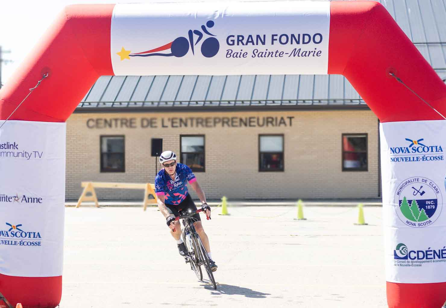
When you travel 3,700km across the country for a cycling event, you always wonder whether the time and cost will be worth it, or whether you should have ridden your last fondo of the year somewhere locally. However, I had read good things about the Gran Fondo Baie Sainte-Marie that is held along the Arcadian shore of eastern Nova Scotia. This year was the tenth anniversary although there had been a three-year hiatus because of the Pandemic from 2020-2.
Flying into Halifax, we were around 300km from the Baie Sainte-Marie coast and had decided to spend a few days before the event on the Bay of Fundy shore. I had brought my Roubaix road bike with me and started to reassemble it on our deck overlooking the ocean as soon as we reached our cottage accommodation. Somehow, I managed to graunch the thread in the derailleur hanger while re-attaching the derailleur but I salvaged enough to gorilla it on adequately for my big ride. Fixing that would have to wait for my return to Calgary.
Reassembling my bike on the deck by the ocean
My first short foray into the surrounding countryside included some 10km on gravel roads that were unavoidable if I wanted to ride a loop. Roads running parallel to the coast linking the tiny settlements appeared mostly to be unpaved, while the paved roads were those running from the highway the coastal villages.. Even these roads were in poor condition and contained numerous ruts, dips and sunken sections. On one steep wash-boarded climb, I had to get off and walk up the gravel as I had insufficient traction on 28mm Continental 5000 tires.
Shoreline riding at Harbourville, NS
Two days before the Gran Fondo, I rode a different loop of 20km where there was only a few km of gravel. The bike rode well and seemed correctly adjusted so, afterwards, I only needed to clean the grit from my chain to be ready for the fondo. I had fitted a small top-tube bag for gels and Veloforte energy bars and a saddle bag with two innertubes, gas and tools. I was intending to use my back light but wasn’t sure I’d need the bell and front light if I could get myself into a fast-moving group.
A quiet ride by the Bay of Fundy
We took accommodation nearer the Gran Fondo start on the Friday night, an Airbnb camper trailer parked by a lake a few kilometres inland from the Baie Sainte-Marie coast, that looks out toward New Brunswick and the US state of Maine. We were enjoying late summer sunshine that wasn’t helping with the drought situation or the continuing wildfire threat but was great for tourists. Luckily, the one large fire in the Annapolis Valley had finally been brought under control the day before and we never saw or smelled smoke.
Colourful wall of buoys at Cape Forchu, NS
From 11am to 5pm the day before the event you could pick up your race number, bike tag transponder and bike jersey. The University Sainte Marie was the registration location and would host the start and finish of the ride. Everything was efficiently organized from the parking direction to the pick up though I felt a bit strange walking up to the stage to sign in and pick up my swag. I hadn’t gone onto a stage to receive anything since high school prize-giving on a hot July day fifty years ago!
As well as the university students, a good number of the local community was helping at the event l, proudly sporting their purple volunteer T-shirts. I wasn’t that sure where I would be parking or assembling the next morning but felt confident these folk would be pointing me in the right direction.
With little else to do in late afternoon, I took a kayak out for a paddle on the lake back at our accommodation and pondered my ride tactics. Having driven some of the route, I had seen the hills were mostly short kickers rising some 20 or 30 metres; the biggest climb was only 50m so it was possible I might be able to keep up with a faster group. I was usually quicker than the lighter climbers on descents so thought I should be able to catch the back of the group before the next climb.
Bangor Mill aid station, one of five
Aid stations were going to be put out at 12, 37, 74, 97 and 116km. I had no intention of stopping at the 12 and 116km points but thought I would likely be pausing at the other three. On previous 100mile (162km) Gran Fondos, I had tended to stop at all the latter aid stations. At the Kentucky Fondo earlier that year, I had stopped at all four aid stations after the 50km point. However, I had not anticipated the strategy of the group I would find myself in on the day for this ride. As it turned out, I would need my complete stash of food that comprised three caffeinated energy gels and three Veloforte energy bars. I was going to mix two 700ml bidons with energy/electrolyte drink and carry powder for one refill, anticipating a ride of 4 ½ to 5 hours.
On Sunday morning, I was awake before dawn, having slept most of the night without waking. There’s normally some nervous tension tugging at me be before an event causing me to lose some sleep. I waited until 6:45am to rise, shower and put the kettle on for tea although I was only intending to drink a half mug; this is my ritual. There was little else I had to do other than eat a bowl of breakfast bran flakes and blueberries – another ritual. I didn’t need to depart until 7:30am.
Lining up for the start of the 128km route
The morning was still and bright, the air temperature about 10⁰C so arm-warmers would give me a more comfortable start. Once Jane was up and ready, we departed for the coast, a twenty minute journey covering a few kilometres of my later route. I had expected to see more cars ahead of me driving to the University but traffic from the south was non-existent. When I reached the start location, I noticed most of the traffic coming in from the north which would have been the logical route it you had got up really earlier and driven the 3 ½ hours from Halifax; I later read that 250 of the 600 entrants had hailed from Nova Scotia’s largest city.
Squinting into the blinding low sun, we made our way towards the marshalling area and I was called forward to the briefing for the long route a little after 8am. The organizing president welcomed us in a mix of French and English and the mascot, a bright red lobster wearing a yellow bike helmet, entertained by goofing with, mostly female, participants lined up at the start.
Al-Fondo the lobster mascot
As always, I scanned the other riders and felt I wasn’t out of place three rows back from the front. The pace suggested for so-called expert and intermediate riders was 27+kph which I predicted considerably underestimated what his crowd would be riding if they organized into a peleton. I was hoping to stay in a group for as long as possible and average at least 30kph, but I wasn’t sure when I would get dropped on a climb.
The alternating French/English countdown from ten released us a short time after 8:30am and we squeezed under the now- commonplace inflated arch and onto the coast road. Fast riders raced up the road and had soon formed a critical mass of 20+ riders that broke away and continued to distance the rest of us. A slower, second group was forming just in front of me and I hitched myself onto the back wheel of a fast-moving female rider who, together with small guy in a bright pink jersey, were bidding to bridge the gap to the second group.
Once we latched onto the group, I focused on staying in the wheels and had no time to take my phone out my back pocket for photos. A glance at my head unit revealed we were pushing 35-40kph on the flatter stretches. I didn’t manage to take in the coastal scenery as we rushed through New Edinburgh but I did acknowledge and appreciate the cheers, waves and cowbells at the roadside. All along the coastal road, locals sitting in lawn chairs or leaning on rails in front of white-painted homes were waving us through.
On the first sharp rise, I applied the power up to 300W and was delighted to stay in the group. The short climb suited my method of high cadence while younger riders were dancing on the pedals. Meanwhile, acquaintances were being made and a pecking order was established. We did not stay in single file once we were off the main coastal road and headed inland. I knew from cycling Google Earth, most of the route would be through tree-lined woodland with occasional landmarks so kept and eye out for these.
Seventy-five minutes into the ride, I thought we should be somewhere near the second aid station at 37km but it was set back at a community hall a hundred metres from the road and in my focused state, I must had ridden straight past it. No-one had shown any inclination to stop which was fine with me as I had drink for perhaps 100km. I chatted with a civil engineer from Halifax for a while but he was towards the back of our pack and I wanted to be nearer the front so when I lost speed on the climbs I could still “sag” into the back of the group and regain my position in mid-pack on the descents.
Amongst our group were six or seven riders from a Halifax club who were wearing a distinctive blue jersey and one of these, rider 802 was a huge guy who was great to draft behind. I was amazed how much power he must have been punching to climb at the speed of people 100lb lighter than himself. As we made our way over climbs near the lake where we were staying that I thought they would have given me more trouble but I felt good in the group even though I was content to stay mid-pack. Most of the time, the same two or three people were pulling this group of twenty riders.
We passed the road leading to “our lake” and were making our way south into a light headwind, not that those of us hiding in the pack really noticed. I was aware the next aid station was coming up at Bangor, a former saw mill. After a little confusion at a junction where our route went right but the aid station was to our left, most of us pulled in to top up drink bottles and grab a banana or energy bar.
We regrouped after just five minutes and continued out to rejoin the coastal road again where a volunteer was holding up traffic for our turn. From there, it was a dozen kilometres to our turning point at the south end of Mavilette Bay that Jane and I had scoped out the day before. There, we’d been for a walk on the sandy beach, watched learner surfers practicing on gentle waves and driven up to Cape Saint Mary’s Llighthouse on the headland.
Still in the group at St Alphonse Church
From a high point by Saint Alphonse Church, I knew the road went mostly downhill to a salt marsh and then kicked up to perhaps the steepest gradient of the whole route. It was on this stretch that I lost contact with the back of the group by only about 50 metres. Naively, I assumed they would all stop once we dropped back down to the aid station at beach level but no, they kept going and the damage was done. As they reformed into a pack on the flat, a couple of us just couldn’t catch up and I soon found myself isolated.
Climbing back up from the salt marsh, I could see the group gradually pulling ahead. 100m metres stretched out agaonizingly slowly to 150m and then 200m by which time I realized I couldn’t continue to push 300W to rejoin. Another of their group blew up on the climb back to Saint Alphonse and before long I had overtaken and distanced him too. For the next 30km I would be riding alone. Only when we merged with the return route for the Medio Fondo riders did I see others but they comprised the tail-enders of a 56km ride so were much slower than me.
Luckily, the southerly wind had picked up and was gifting me 5kph so I estimated I would be back before 12:30pm, under 4 hours, if I didn’t cramp up. I could feel twinges developing in my inner thighs and immediately above my knee caps. Twice before during fondos I had suffered serious cramps. In the most extreme case, in Helena, Montana, I had virtually fallen off the bike when the first attack struck and I could barely crawl back the remaining 10km to the finish where I fell on the grass and writhed in agony for several minutes. More recently, in Washington State, I had pushed myself too hard to stay in a group. On that occasion I pulled over before the finish and had to stretch out before continuing. Neither experience I wanted to repeat and I sensed standing on the pedals and straightening my legs would trigger a cramp so I just kept pedalling. This seemed to work.
On my own, passing the Metaghan River boatyard 20km from finish
Helping me along, psychologically, were the locals, still waving and cheering all along this stretch through small towns, hamlets and houses strung out along the coast. The whole Arcadian community of Clare was proudly behind their event in a way I had only previously experienced on the Strada Bianche fondo in Italy.
Slowly the kilometres ticked by as I passed the stragglers from the Medio Fondo who were completing their shorter route. Overtaking them was an incentive for me though I was more intent on beating my personal target of four hours, not that I could have achieved this without the help of the group for 96km.
The last couple of kilometres, I built up speed to almost 40kph and almost overshot the turn in through the finish arch where my arrival was announced as Ron Eckersley from Calgary, Alberta. As to be expected, most of the riders were from Nova Scotia and New Brunswick but 28 had come over from the United States, probably via the ferry from Maine to Yarmouth that was an hour south of us. Five of us were from Alberta but I didn’t know the other four.
Jane was there too to welcome me home so after stowing my bike in the car we set off for our meals. Mine was a whole lobster dinner and unbeknown to us at the time, Darlene our Airbnb host was one of the volunteers dishing them out. .Sitting in the marquee with live west coast fiddle music playing around us, I assessed this as one of the best fondos I had ever taken part in. There was a great sense of community without overt commercialism or the pressure to raise money for charity. This was sport and community for its own sake.
A celebratory lobster dinner at the finish
When I looked at my timing, I found I had completed the 128km in 3 hours 53mins at and average moving speed of 33kph with an elapsed time of under four hours.. My 100km time was the fastest I had ever ridden that distance, probably because I had never previously managed to stay in a peleton for 100km! Even on this occasion I only managed about 95km in the group but it was enough to get my average speed up to over 30kph for the first time. Consequently, I was very satisfied and considered my training over the summer had paid off.
Route runs clockwise from St Mary’s university
Now for some big gravel rides in the foothills before the snows sweep in.
Living downtown in Calgary, I often see police patrols on bikes, particularly on the central parts of the Bow Trail and busy corridors like 5 Steet between the Elbow and the Bow Rivers. After seeing a posse of eight officers riding past my apartment the other day, I was intrigued to find out more about police using bicycles, especially as I had a family connection to police patrolling by bicycle.
Police cycle patrol on 5th Street Downtown Calgary in October 2024
My father was a police constable in a village in England in the 1960’s and 70’s. His only vehicle in the early years was a black Raliegh 3-speed pedal bike that was kept in a small shed attached to the back of the police station where my family lived. His days on duty entailed cycling to different rendezvous locations around the village that his Seargeant set up by telephone. The Sargeant would then drive to the location that was known as a “Point”. This type of patrolling was called “Point Duty”. As the village covered some 7km by 6km, the distance my father cycled kept him very fit.
Sadly, this all changed when the police first received Triumph Thunderbird motorbikes and then, in the late 1960’s, they migrated to cars. Very soon after, policing in England became centralized on a hub town. This resulted in village police stations becoming redundant and so most were sold off, to police families like ours in the first instance.
I have fond memories of this period but as I was too young, I have no photos. The picture below is typical of what I recall. I remember trying to ride my father’s bike, when I was much too small, and falling foul of the high crossbar!
When you look at the history of police on bikes both in England and in Canada you find they were introduced fairly soon after the invention of a practical bicycle in the 1880’s. The Edmonton police service began in 1890s with just ”two constables, a bicycle, and two whistles”. The Calgary Police Service had been set up a few years earlier than Edmonton’s and it too started with just two Constables. Whether they too had to share a bicycle I couldn’t discover.
Police in Calgary introduced Harley Davison motorbikes in the early 1920’s and gradually the police bicycle inventory disappeared here across Canada and in the UK. It wasn’t until the 1980’s when the idea of community policing on bikes was reintroduced. By then it was realized that isolating police in cars and on motorbikes didn’t make them approachable to the public. In Canada, Edmonton but Calgary and other cities weren’t far behind.
Nowadays, several police districts in Calgary mount bike patrols. They’ve tried fat bikes in winter and mountain bikes for Fish Creek Park and have previously stated that their cycle patrols are 12 months of the year. So far I’ve only seen them on the pathways in summer but I welcome your observations of bike police in the city.
Compared to some ancient towns in Europe, we don’t do really steep paved roads in Calgary. That said, most of us know one or two hills that test our resilience. With the Bow River cutting through the city, it’s not surprising that the steepest paths track up from river level to the bluffs above. As the river wended its way across the landscape, it eroded steeper cliffs on outer bends and that’s where the particularly tough gradients arise. Armed with a few tips on where to look, I went out to explore our steepest climbs.
Steep climbs from the Bow River in the west of the city
In the east, at Bowness Park, you only have to think of the new Zig- Zags under the Stoney Trail climbing to Valley Ridge in the south. On the north side of the river, sections of the new path up to Tuscany station are tough but in reality they rarely hit even 10 degrees or 17%. In Bowmont Park, there’s a gnarly section climbing up to Silver Crest Drive but again its not more than 20% At the east end of the Park, Home Road climbs steeply to 32 Avenue but doesn’t smash the magic 20% mark. Nor too does the short stub of 52 Street in the same location
Climbing up the Zig-Zags under the Stoney Trail in Spring
Continuing downstream, there’s the tedious climb out of Edworthy Park south to Spruce Drive but while its long, its gradient is modest. A snappier climb occurs downstream where a cycle path branches off the Bow River Pathway at the east end of the Shaganappi Golf Course and climbs 30 metres to Sovereign Crescent. However, I had been told to look further east in Crescent Heights where there was a slope that was well over 20%.
Climbs in the central zone
To reach Crescent Heights, there are a couple of warm-up cimbs on route. Centre Street rises gently from the city centre but on the north bank of the river it drops you at the foot of Samis Road that curves eastwards and ramps up to 15%. If you had time to glance right, you’d appreciate the curved geometry of the Bow Building directly south of you across the river. I did stop at the top of the hill to take in the view, noticing that the river level was starting to drop and its colour was returning to its more had usual hue of dark green blue.
After a respite on 2 Avenue NE , I turned right on 2 St NE, stopping at the top of what is purported to be the steepest paved lane in Calgary. The unnamed alley between 2 Ave NE and 1 Ave NE certainly dropped away rapidly after the first 100m. I stopped and squinted down the last 100m to 3 St NE. The path was about 3 metres wide but the surface was not smooth asphalt. I started off riding down but considered it too dodgy to continue so carefully walked down the rest in my cleats.
Having got to the foot of the hill, I had no intention of trying to ride back up. My clinometer app indicated the peak gradient was 16⁰ (28.7%) but this wasn’t the only reason I opted out of this climb. At the base of the climb, the lane was closed by barriers for construction work on a drain that ran under 3 St NE. Consequently, you would have to begin from a standing start at 16⁰ and try to clip in and continue upwards. If that wasn’t bad enough. the lane was too narrow to allow you to zig-zag to alleviate the gradient.
Disappointed but somewhat relieved, I moved on to my next target which was 2 Ave NE that ran parallel off 3 St NE. At some point in the past, 2 Ave NE had been a proper paved road, but car access was now barred by permanent barriers at the top and bottom of the steepest section of 80m. There was, however, plenty of room to ride a bike around the barriers so I had my challenge.
Detail of Crescent Heights between 1 and 2 Ave NE off 3 St NE (Downhill indicated by arrow)
Starting in 3 St NE, I turned around the barrier onto the ramp and kept climbing up managing 8 to 9kph most of the way. When I looked at my power figures afterwards, I saw I needed 350-400 Watts to maintain my speed on a slope that averaged 13⁰ and peaked at 14⁰ (25%). I’m not sure I could have maintained that level of power for much longer than the minute it took me to reach flatter ground!
With my legs sufficiently warmed from the effort, I took 8 Avenue to the Nose Creek Trail and then blasted down the east Bow Trail knocking up several personal best times on the way.
When you consider what we do have for climbing around Calgary, the hills aren’t too long and aren’t too steep and are not going to condition you to a tour in the Swiss Alps. For that training, you would have to head west for Kananaskis or the Rockies. Even there, the road climbs may be long but they are never particularly steep as they tend to reflect the capabilities of cars from a hundred years ago.
If you know of any climbs I’ve missed add these to the comments.
You frequently see mountain bikers threading their way through the trails in Nose Hill Park, but just how suitable is it for gravel bikes when you get off the asphalt paths? Well, I’ve been up there many times in different seasons and have some thoughts on this. Firstly, though, I would advise that if you’re new to gravel biking and don’t have previous off-road experience, then get some initial kilometres riding the farm roads north or east of Calgary.
It’s true if you want to ride all the available trails on Nose Hill, then a mountain bike is more suitable than a gravel bike. A mountain bike has a bigger selection of low gears and suspension that make the riding easier on the legs, arms and seat. However, most of the trails are manageable on a gravel bike with wide-enough tires. 45mm tires are ideal but I have ridden on 38mm tires when the trails are firm and dry.
Most gravel bikes work well up to gradients of 10%, but Nose Hill has steep sides where the grade can exceed 15%. Climbing these on a gravel bike demands a huge amount of power or you will quickly run out of low gears. Also, there are the steep downhill sections where your speed can quickly build up so control can be difficult without front suspension. However, it’s still possible to find gravel trails at the top of the park that don’t have long steep slopes.
The best place to start out from is the northwest park lot on the Shaganappi Trail. An asphalt path begins at the southern edge of the car park by the washrooms, and taking this gives you a chance to warm up and test your bike on a firm surface. After two minutes of freewheeling downhill, you reach an intersection with a paved path ahead and another to your right. Left is a wide gravel ramp. A prominent sign indicating “Entering off-leash area” is your cue to turn right.
Turn right at first intersection by Off Leash Area sign
Here is a chance to run through your climbing gears on a gentle rise so that the very tops of the towers downtown come into view. Continue southwards on the path with ever more of the city coming into view. Most prominent are the Red, Green, Yellow and Orange Buildings at University City in Brentwood. Across the valley, you can make out the ski jump in the Olympic Park.
The path swings left again so you are travelling eastward turning back to the right with the Downtown towers in front of you again. You will have been riding about 15 minutes and will have covered 3km when you approach a copse of trees and can see the path below to the right. This is your cue to slow down as you are about to enter the gravel trail that branches off to the left. The trail is immediately before a steep hill sign “Maximum 10”.
The copse of trees is your cue you are about to turn left onto gravel trailGravel trail starts immediately before steep hill and Maximum 10 sign
Navigating the trails once you leave the paving is often a problem on Nose Hill. I have frequently found myself in a new area by accident. With this route, though, route-finding is not a problem as you continually skirt the “Off Leash Area” that is marked by signs on posts every 200m or so. If you always keep the “Off-Leash Area” signs on your left, you will be on the correct route. The gravel path you will be following is mostly one to two metres wide.
Always have the Off Leash Area signs on your left and be careful at turns at turns
Almost immediately, you meet a downhill section into trees where the surface may be wet after rain. Keep your speed down and get used to controlling your bike on the loose surface. At any intersection, look for the “Off-Leash Area” signs ahead to take the correct turn. There is one short, steep section before you reach the Big Rocks viewpoint. Keep your weight on the rear wheel to avoid spinning out, but there’s no shame in walking up this ramp.
Your route bends more northerly past the Big Rocks Viewpoint from where you can gaze across Highway 2 to the airport and runway beyond. Continuing the circuit, you loop around a deep gulley. The paths here have gravel that can be deep and loose after heavy rain. Also, I recently found deep cracks eroded in the path from storm runoff, so keep your speed down as necessary.
After a sharp left turn, you encounter a slightly longer ramp that will definitely test your climbing skills and fitness. Again, walk if necessary as there’s only 15 metres to ascend. Your reward is a long section of gentle riding back towards the northwest. Always confirm the Off-Leash Area signs are on your left side. Eventually, the gravel runs out where you intersect the paved trail coming in from 14 Street NW. Take a left here and follow the path back towards your parking area Shaganappi Trail.
Your route skirts the perimiter of the larger, southern lobe of the Off Leash Area
If you managed all the climbs on this route without walking, you may like one more challenge. At the point where you first turned right, 400m from the parking lot, you will remember there was a gravel ramp on your left. This gravel ramp will be on your right when retuning. Climbing this ramp takes you directly to the centre of the parking area. Otherwise, continue over the intersection and reverse your outbound route from the washrooms.
If you find this route straightforward, then you are ready to embark on another Nose Hill adventure. You could try to load a course on your bike computer or just wing it when you are on the hill. Sooner or later, you will find a slope that defeats you but you should quickly find your way back to rideable terrain. As well as the narrower gravel paths, you will find a veritable web of single-track mountain bike trails over grass and mud. Some of these descend steeply into the two deep gulleys on the eastern flank and are best avoided.
First 3 km are paved in an anti-clockwise circuit of 11km that will take about an hour with stops
A number of routes are listed on the site below, but remember these are aimed at mountain bikers. Nose Hill Park Mountain Biking Trails | Trailforks ( Green trails are easiest under their grading system)
When you plan a route to the north, east or west of Calgary, you inevitably enter Rocky View County that mostly encircles the city like an upside-down horseshoe. From Downtown, the shortest route out of the city limits is about 15km west on the Banff Old Coach Road at Cougar Ridge. To the northwest, the distance stretches to 25km before you cross Country Hills Boulevard on 12-Mile Coulee or Rocky Ridge Road. The route in this blog goes from the city centre to Bearspaw, located just outside Calgary’s northwest limits.
You could start exploring the northwest by starting out from the Shane Homes YMCA. The parking lot at this futuristic-looking facility off Rocky Ridge Road is conveniently located and big enough to accommodate a couple of extra cars if you want to skip those 25km to get out of out of town. However, I usually embrace the full ride out of town with its 200m climb up from the Bow River. On my latest ride I discovered a new trail up from Bowmont Park that avoids going through Baker Path to reach Tuscany.
Bow River seen through Cottonwood Trees in Bowmont Park
On that ride for variety, I opted to climb to Tuscany on Tuscany Hill as there is a parallel cycle path. However, Tuscany Hill road has been engineered at a constant grade while the bike route throws in a couple of steep knee-straining ramps so beware. At Tuscany Drive, I took a left, following the road this time as the whole area was very quiet, being early afternoon on a weekday in the summer. A handy gravel cut though connects to 12-Mile Coulee at Tuscany Ridge Terrace. Those road names are pretty confusing with so many similar sounding: Tuscany Ridge Terrace, Tuscany Ridge Crescent, Tuscany Ridge Way, Tuscany Ridge View, Tuscany Ridge Common.
Homes packed together in Tuscany Parkland home in Bearspaw
You can head uphill on 12-Mile Coulee, cross Highway 1A and continue up to Country Hills Boulevard. Hang a left there and you are suddenly in Rocky View County, specifically, the district of Bearspaw. Immediately, the density of housing you saw in Tuscany drops dramatically as you enter the manicured parkland around Bearspaw Golf Club. A road snakes through the estate taking you past large homes on huge plots and bringing you out to an intersection with Bearspaw Road.
When you head north on Bearspaw Road, few of the side roads seem to have exits as they loop round in what the district calls “pan handles” where the homes sprout off the outside of these loops. Although a sign at the entrance to Church Ranches Boulevard indicates “No Through Road” the Boulevard does continue all the way through to the east and rejoins 12-Mile Coulee. Whether the sign is a sleight to reduce through traffic, or an oversight, I couldn’t say. If you ignore this option, you need to keep riding north to a township road where you can choose to ride east or west. The township roads would have been there long before the farmland was carved into two-acre residential plots.
Pleasant Lakes and Hills for Cycling
Many of the homes here are situated around small lakes, and the gently rolling, wooded hills that make for enjoyable cycling terrain. Having explored Bearspaw, you can return back down Rock Ridge Road, past the YMCA. This road takes you rapidly downhill past the Mormon Temple to the Tuscany C-Train station. From the station, the downhill continues until you reach the Bow River under the Stoney Trail. Having lost 200m elevation in a relatively short distance, now follow the bike lane by the side of Bowness Road back over the Bow River and rejoin the river trail via Home Road in Montgomery. From there, it is 30 to 40-minute ride back to Downtown.
The overall ride described is 60km long and will take 2½ to 3 hours on a road bike in dry, summer conditions, depending on your riding speed.
I have a favourite 50km route that departs from Downtown, heads down river on one bank of the Bow and then and returns on the opposite side in an elegant loop. The views change continuously and are very different on the return leg, where the tower blocks of Downtown beckon you back.
Heading upstream, I would like to find an equivalent loop but west of Edworthy Park it is difficult to remain near the river on the south bank. My usual 40km circuit has me crossing back over on the Edworthy footbridge, and riding through Shouldice Park to recross the river into Bowness. From Bowness, I find myself climbing up to the Calgary Olympic Park and exiting to the east under the Stoney Trail before dropping back down through Valley Ridge to the zig-zags that take me down to the river crossing under the Stoney Trail at the west end of Bowness Park. This is the last crossing before Cochrane.
The cycle path at Wildwood on the way to Edworthy Park from Downtown
If you stay south of the river at Edworthy Park, what are the options? You could always climb up the park road, cross the Shaganappi trail, climb further up the twisty cycle path to the Old Coach Road and then head west from there dropping down through Cougar Ridge to the Calgary Olympic Park. This route inevitably takes you through development on busy roads and involves additional climbing. But can you ride west in Edworthy Park?
I investigated, first, the Christmas Tree Trail that hugs the river but this is really just a grassy footpath that gets pinched out after a few hundred metres where the river and railway converge. Trail finding apps like Trailforks portray a blue category mountain bike trail called Brickburn that runs west from the Edworthy parking lot and parallels the south side of the railway. However, when I got there, I found my way barred by a new chain-link fence and padlocked gates. While the route is also shown on the Ride with GPS map, it is no longer marked on the Alltrails app and is not shown on the City of Calgary on-line map for trails.
I quickly discovered I did not have enough gears to cope
As I couldn’t physically access the Brickburn Trail, I needed to look for alternative which meant looking back uphill in the parking lot. There, I saw an unpaved road that struck west but I couldn’t go further than a turnaround area as a sign indicated the road beyond was private. Apparently, there are several private homes inside the park boundary. Another trail, the Crackendale/Edworthy Car Park Connector was also shown starting there on some maps. This was categorized as a green, moderate, mountain bike route.
Single track forming the Green connector trail bypassing private property in Edworthy Park
I looked carefully around the vegetation and found the entrance to this narrow, single-track trail that circumvents the private land, as it climbs obliquely towards the west. Riding a gravel bike, though I quickly discovered I did not have enough gears to cope with the initial ascent over gnarly tree roots.
No sooner had the trail levelled out than it dropped back down toward the railway line where again you are greeted with a chain-link fence, possibly erected to stop riders crossing the tracks to link with the Christmas Tree Trail. However, a soggy bypass path goes west and, before long, it has become the original Brickburn Trail paralleling the rail track. From here onwards, there are few signs that the route is regularly ridden anymore.
The route I rode is not suitable for road or gravel bikes
A steep ramp, that I couldn’t ride, hauls you up to a bench and then to a great viewpoint with a vista over the valley to the brightly-coloured Children’s Hospital on the far slopes. Steep, but manageable descents take you back down to railway level and at one point you skirt the very edge of the railway to cross a stream.
Gnarly roots and steep ramps at times
By the time you have lost that height, you are out of the Park although I saw no boundary signs. The trail continues through a corridor of mixed trees and shrubs, with the railway to your right and cleared pasture on your left. It is unclear, as you approach from the southeast, who owns this land but where you near the exit for Bowdale Crescent, two signs inform you it is CP Rail Property and No Trespassing is permitted.
Route investigated running northwest from Edworthy Park to Bowdale Crescent
After the ride, I found a web site describing the City of Calgary’s Freight Rail Corridors Policy for developments. The map clearly indicates that the trail I had been riding was in the rail corridor that covers land about 30metres each side of the railway. Formal City cycle paths infringe this corridor further east of Edworthy Park but the path there is always segregated from the railway by a high chain-link fence.
The attractive but invasive species of Yellow Clematis found in the meadow near Bowdale Crescent
Once you reach Bowdale Crescent, there is no question you are on a legitimate bike-permissible road. Continue westwards and you pass through a series of three underpasses at the Sarcee Trail which allow you to access Na A Drive SW leading you further to Canada Olympic Drive where you can connect to Valley Ridge Boulevard to reach the bike trail to the zig zags down to Bowness Park.
The cycle path only infringes the Rail Corridor where there is a separating fence
So, for now, I think an effective link between Edworthy Park and the Calgary Olympic Park is still missing. The route I rode is not suitable for road or gravel bikes and I will not be riding it again. If you do ride it, be aware that its status is dubious as it seems CP Rail is not allowing you to infringe the rail corridor unless the track is separated from the trail by a fence.