Category: Blogs

Thoughts and recent events.

  • Gravel to Vulcan – Beam me up!

    Gravel to Vulcan – Beam me up!

    Taking advantage of the numerous gravel roads on the prairies to the south and east of Calgary, I mapped out a route to the town of Vulcan that would be almost entirely unpaved once I had left the city limits.  This would be a one-way ride of 130km with over 100km unpaved.

    Route from downtown Calgary to Vulcan

    In order to avoid the summer heat, I needed to be in Vulcan by 1pm which meant departing at around 5:30am.  I planned to stop at Carseland after 66km for a second breakfast and then meet Jane at Mossleigh (90km) for coffee. That would leave me a further 40km ride to Vulcan. With a favourable wind and fast surfaces, I was expecting to average 22kph. 

    Leaving Calgary that early on a Sunday morning, I encountered only a handful of early dog walkers and runners. It was also early enough that the paths were still damp from nighttime lawn sprinklers and the air felt cold on my arms (10°C).  I wanted to depart the city the most expedient way so headed out to the south of Chestermere via 50 Avenue SE.

    Township Road 240 in Janet at sunrise

    As the sun rose, a red orb, I realized there was still smoke in the air from the Northwest Territories. I was expecting a wind from that direction but I sensed light air moving from the south to southwest towards me; not ideal.  

    At the eastern edge of the city, I rode on a familiar stretch of road through Janet, only to discover that the gravel had been refreshed recently with new river pebbles. This surface did not give me the fast start I had bargained on and I was irked by the extra effort I needed to exert to maintain 20kph. 

    Range Road 252 south of Carseland Canal – typical of gravel surface ridden

    Immediately south of Chestermere, where you cross the Rainbow Road,   the gravel transitions back to asphalt so my speed and spirits picked up. Returning to gravel again at Range Road 281, I was glad to find the surface much the same as when I last ridden it, but I still faced a gently headwind. The wind forecast on my Windfinder App was evidently wrong and I knew the wind I faced would likely build once the sun rose further. 

    Heading south on that gravel stretch, I also realized the sun would be in my face for most of the ride. While I was wearing dark sunglasses, a peaked cap would have made it easier for me to be able to read the gravel surface ahead.  At least when I swung onto easterly sections, the wind was slightly at my back though it wasn’t strong enough to make a noticeable difference. 

    Ruined farmhouse -one of many on the prairies

    I had never ridden this route to Carseland before and my head unit map was so zoomed in so I wasn’t exactly sure how much further I had to ride. Consequently, I relied on my speed and elapsed time to assess my progress towards breakfast.  

    Several farms enroute were flying flags of allegiance to either the province or the country, ahead of autumn’s poll on independence.  In the past, these flags would have been viewed as innocuous displays of pride in our country or province, but not this summer.

    When my watch indicated I had been riding almost 3 hours, I could see a settlement to my left across the bright yellow oil seed fields; I was approaching Carseland.  As I rode into town, I noticed an old guy sitting on a bench outside the diner, but there were no lights on inside.  Fearing the worst, I dismounted and approached the door where a sign informed me it wouldn’t open until 9am.  I guess that’s the problem when you rely on Google Maps for opening times.  It wasn’t even 8:30am and as I had no intention of hanging around for half an hour, I  reluctantly set off on the paved highway to the Bow River crossing.  I still had a caffeinated gel, two bananas and a couple of energy bars as well as almost full bidon of energy drink to sustain me.

    Fast moving water in the Carseland Canal

    Immediately south of the Bow River, I turned onto a gravel road and would be on gravel for almost all of the remaining kilometres.  As the road wended its way further south, I crossed over the Carseland Canal that was brimming full and flowing swiftly.  A short climb up from there took me from the Bow River meadows onto the prairie.

    I knew I had another 24km to Mossleigh so just knuckled down and, after just over an hour, my first sight of Mossleigh  was the trio of grain elevators aligned along the former rail track.  On reaching the main road, Highway 23, I only needed to cross over and I was at the Aspen Outpost roadhouse.  I was more than half an hour earlier than my planned rendezvous time because of skipping the break at Carseland. Those first 90km had seemed hard work but at least the wind hadn’t picked up further and was still a light southwesterly.  

    Now feeling very hungry,  I was more than  ready for a full cooked breakfast and several mugs of coffee. A pair of RCMP officers were finishing their meals when I arrived and were discussing with the waitress where help would come from if she called 911.  Apparently, the roadhouse was just about the farthest point from all three detachments in the area so, whichever unit responded, help wasn’t going to arrive very quickly.  

    Range Road 245 south of Mossleigh

    I was in no hurry to rush away when Jane arrived so had a third refill to steel myself for the last 40km.  When I did eventually leave, I was feeling revived and my spirits were lifted further by spotting a strangle animal in my path.  My first impression was of a squat, cat-like creature with relatively short legs supporting a monotone body that was wider than it was deep.  It was nonchalantly strolling down the gravel road and only scurried away when it saw me.  After trying to hide in the grass by the side of the road, it disappeared into the crops before I could snap  a photo.  Faint head markings identified this to me as an American badger that is supposedly an uncommon nocturnal resident in the prairies.  

    Geographically, the lowest point  of my route had been the Bow River crossing. After the river and Mossleigh, I faced a series of gentle climbs across arable land with numerous fields coloured bright yellow from oil seed flowers.  There was no traffic. I think I saw two farm pickups in the whole of that last leg of 40km.

    Range Road 245 north of Vulcan – some kilometres north of Vulcan

    At one point, I passed a “No Exit” sign where the road immediately transitioned to two narrow strips of hard mud in a green lane.  Luckily, the baked mud ran fast and the grass never completely took over. Even so, I had six kilometres to run before exiting onto a wider gravel road.  Ironically, the loose gravel was slower to ride.   

    Eventually, I spotted a water tower on stilts, a few kilometres away across the fields southeast of me.  Recalling that there were no other settlements on my route between Mossleigh and Vulcan, I concluded that it had to be my destination.  When I crossed the railway track and turned towards the tower, I knew I was almost there. 

    Railway siding at Vulcan with modern grain elevator on horizon

    Nowadays, there are no wooden grain elevators on that siding; the last was demolished in 2025.  At its peak, when Vulcan boasted the greatest grain storage capacity of any town in Canada, there were twelve elevators. I rode into town past the remaining concrete elevator but it’s not much to look at.  

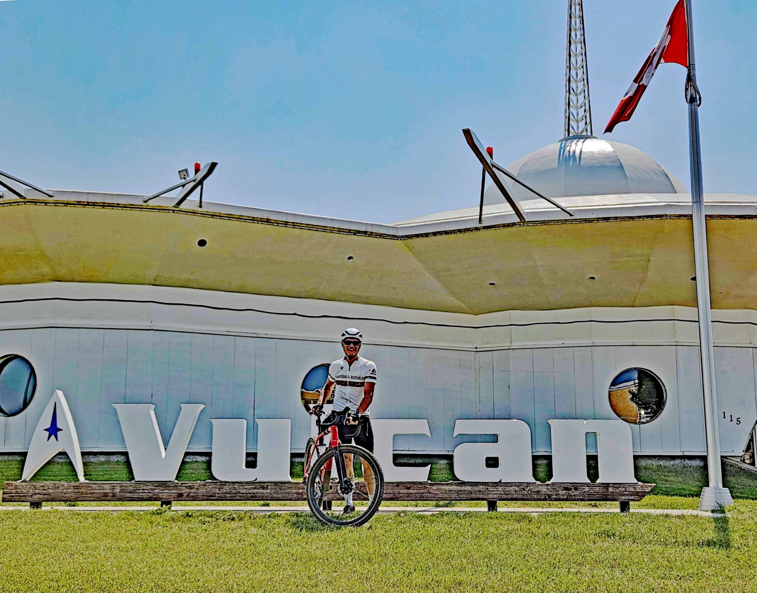
    Just the last few hundred metres of road to the tourist information office were paved.  The building there is modelled as a spaceship following  the town’s initiative to capitalize on the  Startrek theme because of its name, Vulcan.  The town was actually named by  Canadian Pacific Railways half a century before Startrek and the planet Vulcan were envisaged by Gene Rodenberry.   

    Starship Enterprise is the pride of Vulcan

    A few hundred metres behind the tourist information office is a model of the Enterprise on a plinth for tourists to use as a photo backdrop on their way through the town. That Sunday, just about every business was closed so I was grateful to find a café that was open where I could get out of the heat and enjoy another big meal.   I had ridden for 6 hours 10 mins and covered 130km, 100km of which was gravel or hard mud.  

  • Foothills Gravel

    You need look no further than the Foothills for hilly gravel riding and the route I was riding had 15 climbs that Garmin thought worth marking. Those 15 climbs would amount to almost 1500m of ascent in 107km of cycling so an appreciable tally.  Ride with GPS suggests there are 68km of gravel which is about right as the “unknown” sections are all paved, so that’s around 62% unpaved.

    Location of the Foothills southwest of Calgary

    I was riding with two others, thrown together to undertake to longer of the three ride options offered for a Terry Fox Charity ride.  Other participants took the shorter routes, perhaps with some prior knowledge of the hills to be encountered or anticipating the strong winds that would develop after midday.

    Full group before the three split off to ride the longer route

    Our route set off from the eastern part of Diamond Valley, some 50 minutes southwest of Calgary at the edge of the Foothills.  The town of Diamond Valley, I learned,  comprises the recently amalgamated former coal mining towns  of Diamond Valley and Black Diamond that are located a couple of kilometres apart.  Before setting off, I enjoyed a coffee at The Stop ,which should certainly be visited if your  route includes passing through the town.

    Settling off in a gaggle with the shorter route riders, we meandered west to cross the Sheep River and then struck north on what was portrayed as a gravel road but was actually fast asphalt, especially with a tailwind. My Garmin wind app indicated around 10kph from the southwest but I sensed it was already beginning to pick up.

    Initial scenery riding north from Diamond Valley

    At around the 5km point, our trio rode on ahead and had a decision to make at the Three Point Creek crossing. Usually, by mid July, fording the creek is an amusing distraction as the water is only a few inches deep.  However, this year with all the spring rain and late snow melt the creek was running briskly and was over a foot deep.  Truman, one our trio, led the way and was immediately surprised by a 4” lip and kerb under the water before the main current.  However, we found it relatively easy to cross, provided you kept pedalling but that meant two soakers were unavoidable.  We concluded there would be plenty of time to dry out over the ensuing five hours!

    Beyond the creek, we did encounter gravel on Range Road 23 A but  to continue north, we needed to ride on Highway 549 for a while until it swung west and we swung east and then north on 160 Street East, a true gravel road.   The route undulated and climbed over a couple of low ridges but the height we had accumulated was lost on 274 Avenue that struck west.  At least this paved road allowed us to descend at full speed without fear of the crosswind affecting us at it would later on gravel road descents.

    Grassy trail above Millarville ( photo Nathan Kristensen)

    The cross headwind on this stretch, that lead us into the foothills proper, gave us a taste of things to come.  Luckily, our first southerly section on 224 Street W was  wooded, protecting us from the full force of the wind.  There were some steep, unpaved climbs on this section that had me grinding the granny gear.   At the top of the last climb before the drop to Millarville, we took in the great view across to the high Rockies west of us.

    Our descent came to a grinding halt when I led us down into a farm yard blocked by an outbuilding.  There appeared to be no exit but Nathan realized we had missed the fork to a narrow grassy track that continued running south immediately before the farm.  A slow uphill back track took us to an unlikely looking trail that looked more like a grassy footpath than a bike trail.   I set off in the lead and was immediately enthralled by the descending path ahead of me.  Had I ridden the trail before, we could have raced down into Millarville but in the dappled sunlight  caused by the surrounding deciduous woodland, it was hard to see the bumps and dips. 

    The enclosed path debouched into a grassy meadow with a twisting path leading us out past the gas station workshop to the Millerville General Store.   After a brief stop to pick up some water, we were back on smooth pavement,  continuing northwest on another stretch of Highway 549 that took us ever further into the hills.  I think both Nathan and I were glad Truman was happy to  pull away on the front as the combination of climbs and wind was a struggle. 

    Long Descents

    As we crested a hill on Highway 549, I was initially puzzled why the Garmin showed us continuing to climb.  All was revealed when my route arrow pointed left onto a gravel climb, 304 Street W.    With the wind coming in from our front right, we climbed and descended a couple of hills, ever mindful of fierce gusts tugging at our wheels on fast downhills.  The wind meter showed 37kph but the gusts were more like 50kph.

    There was some respite on 233B Drive W that wended its way northeast but at 288 Street W we had to turn south once again.  After more jinks to the north,  our route finally wiggled south east into the former Turner Valley end of Diamond Valley.   I was more than happy for another brief stop at the Esso gas station to pick up more water and pause for a bit of my cheese sandwich.  Up to that point, I had subsisted on Clif bars and a banana, though I did chug down a caffeinated energy gel before one of the bigger hills.

    A glance at the route  showed we only 63km into our route but it certainly felt further because of the hills and wind.  There were still several hills to take in and we still had to ride south for a further 20km.  While there were tentative suggestions to curtail the most southerly parts of the route, they came to nought and we cycled on, initially up the longest and highest climb of the day.  Each of us travelled at our own pace as there was no drafting advantage at that slower speed.  By then, Nathan, the least trained of our group,  was beginning to slow on the ascents.

    By the time we turned south at Highway 22 and rode north for a kilometre, the wind at our backs and downhill gradient sped us up to 60kph. That pace wouldn’t last after we turned cautiously east onto the gravel at 530Ave W.  Even when we turned north, the climbing took away some of the wind benefit.

    Full route from Diamond Valley, counter-clockwise

    Faced with yet more climbing on gravel and seeing Daimond Valley away to the northwest, the consensus was to ride west and then north instead of north and then west.  Truman thought this would avoid one last big hill and give us a fast run into our destination on Highway 22.  My Garmin had  indicated we had completed all 15 marked climbs but I was okay to agree to the plan.  When I subsequently compared both options, it seemed there was little difference.

    Final approach on dirt road towards Diamond Valley

    On the last leg west towards Highway 22 we passed a pair of ponds where some Black Terns, rose in alarm and flapped just above my head as a warning gesture.  I had not seen these birds since living in England but they are, apparently, different sub-species, with the European sub-species being a little larger.   

    With only 6km to go, we turned onto Highway 22 and prepared ourselves for the fast run back to Diamond Valley. We hit 65kph on the first descent and maintained 40kph to the town limits where traffic forced us to be more cautious.  

    I was satisfied to have completed the route though we had stopped more frequently than I would have, particularly at the top of every hill towards the end.  Consequently, we amassed 1 ¼ hours of stoppage with 5 ¼ hours of moving. The exact distance was 107km with 1485m of ascent.  An ice-cold orange popsicle with cream filling was all I needed to complete a fine challenge for a good cause.    I had discovered more gravel routes in the Foothills so it had been a great day out.

  • Biking the Upper Bow Valley

    I have cycled various parts of this route several times over the past 10 years, even when I wasn’t then living in Alberta. There is so much on the ride that encapsulates what Canada and the Rockies represent so I have always found it is worth going back for more.  Banff is central to most routes and is one of the most popular destinations for oversees tourists.  If you cycle from Canmore, Banff also marks the transition from a separated cycleway to the seasonal Parkway which is normally shared with motor traffic.

    Group ride on the Parkway before it was open to motor traffic for the season

    I first rode on the Bow Valley Parkway in 2016 when I had a few hours to kill in Banff before taking my son back to BC.  In that, pre-pandemic era, I rented a quality road bike in the town and set off west skirting the Vermillion Lakes, with their fantastic end on view of Sulphur Mountain, to the start of the Parkway.  It was the end of May which meant the Parkway was not yet open to motor traffic so I had the road to myself. There weren’t even any other cyclists beyond the Vermillion Lakes. 

    My destination that day was Johnston Canyon, the end of the car-free section and some 30km from the centre of Banff.    Although there is a notable hill to climb where the east and west bound carriageways separate, the route is gently undulating with slightly more downhill for the return and some 600m total ascending.

    As you cycle west, you mostly have a high ridge and eventually Castle Mountain on your right side and the Bow River to your left. Through breaks in the coniferous forest,  you get fine views of the Rockies to the south. However, you need to remember conditions can change rapidly in the mountains, with cloud and rain developing from a seemingly clear sky. That’s the reason why the upper Bow Valley is so luxuriantly green!

    Most people stop for a photo at the prominent Bow Valley Parkway sign near Banff

    I was sad I had to turn round at Johnstone Canyon and head back to Banff for my appointment that first time.  It had been one of those glorious spring days when the fair-weather clouds and blue sky had held and the air was cool but not too cold.   It would have been wonderful to have carried on west to Lake Louise but I wouldn’t complete that leg for another 8 years.        

    The next time I rode the Bow Parkway I started at Castle Junction and rode east, having set off from Kootenay Park Lodge at sunrise. Sadly, the historic Lodge is permanently closed now, possibly a victim of the lean Pandemic years. I stayed there during the second summer of the Pandemic on a ride from BC to Calgary.  I departed Kootenay Lodge that day dressed for the warmer temperatures I expected later in the ride. Consequently, I was not prepared for temperatures hovering just above zero and by the time I reached the Bow Valley my hands were numb and upper body chilled even after two hours of hard riding.

    Elk and sometimes bears are often seen before the Parkway opens to traffic

    I had the Parkway to myself but really I only focused on trying to stay warm and trying to catch the early rays of sun.  My immediate destination was a breakfast café in Canmore so I minimized my time negotiating Banff by staying on the shoulder of the Trans-Canada Highway.  As I had been riding on other major highways for the previous five days by that stage in my journey, I wasn’t bothered by the traffic that was supposed to be adhering to the National Park speed limit of 80kph.

    After Banff, I opted for the cycle-only Rocky Mountain Legacy Trail Banff, and headed for the Summit Café in Canmore.  I recall the breakfast being particularly fine and this set me up for the final 90km into Calgary; Cochrane Hill just about finished me off though.  

    The occasion when I had most time to enjoy the scenery on the Bow Valley Parkway was on a group ride from Banff to Lake Louise.  This was on a weekend at the end of June when the Parkway was free of motor traffic as far as Johnstone Canyon. 

    Each year it seems more difficult to get parking at Banff, even at the huge parking lot north of the town. Consequently, our group met up for a 9am start.    While we were fast, I had time to admire the views and to see a black bear just east of Johnstone Canyon.  We had enough riders to split into two groups and I was happy enough to take the “relaxed” option.  

    When we reached the turning for Lake Louise  we turned left for the town site and had originally planned to cycle up to Moraine Lake. However, thundery clouds threatened to spoil our day as happens often in the mountain in summer so we broke for a coffee and water stop before turning back.  The ”shortened” ride was just shy of 120km.

    Lake Louise Ski Lodge is a great location to refuel before returning to Banff or Canmore

    An option for this route is to begin at Canmore that is less touristy and then to cycle the Rocky Mountain Legacy Trail up to Banff.  If you turn around at the Lake Louise ski resort, this gives you a fine Century ride of 162km  and you can claim a free can of beer at the ski lodge if you show you cycled from Banff.  I rode this route in a fast group on Canada Day when the roads were open to traffic but there were never enough vehicles to trouble us.

    Again, thundery weather threatened us later in the ride, so from Banff back to Canmore, I was grateful for wearing a shower proof jacket. Even so,  I was still drenched by the time I reached the Canmore parking lot at the former tourist information office. Nowadays, the building is merely a gloried washroom!   

    The return route from Canmore to the Lake Louise Ski Resort

    So, there are several options for the Bow Valley and I think my favourite would be the ride from Banff to Lake Louise before the Parkway opened to traffic, say in late June.  Next time I ride this route, I am determined to climb the hill to Moraine lake too

  • Biking the Badlands

    Drumheller, famously known for its dinosaur museum, lies on the Red Deer River where it cuts through the Badlands of Alberta.   The river valley is narrow and steep-sided revealing stripy layers of mud and ash laid down 70 million years ago and carved into deep gulleys after the last Ice Age.   This land is barren, lumpy and unusable for crops but away from the river and its feeder valleys the land transitions to the prairie plateau.   On the plateau, you can see for miles across the gentle undulating arable landscape.

    I was staying in Rosedale some 6km downriver from Drumheller, and had planned a route that encompassed views of the Badlands and the wide prairie above it, taking advantage of the web of gravel roads that cover the area south of the Red Deer River.  I was also taking advantage of the early sunrise at that time of the year.  Traffic wouldn’t be an issue as the roads are only used for access to farms, small oil installations and wind generators, and these are few and far between.

    View of Rosedale elevator across the Rosebud River near start of ride

    The evening that I arrived in Rosedale there was a sprinkling of rain that, fortunately, would do nothing more than help suppress dust on unpaved roads.  I had ridden in this area previously after heavy rain and that had turned the road surface to a thick mud which bound loose chippings to my tires reducing my speed to a crawl.  My luck was in this time.

    Setting off at sunrise, I needed a jacket to keep of the chill as I made my way south up the Rosebud River valley on the 10X road towards Wayne a former coal mining village.  The original planners intended the road to run directly up the gently sloping valley to Wayne but the river has other ideas as it constantly wends across the valley floor.   Consequently, the road has to cross the river no less than eleven times in only six kilometres.   

    One of the eleven bridges over the Rosebud River on the way to Wayne

    Wayne is a spread-out collection of modest homes so the two-storey Last Chance Saloon is easy to spot off on the west side of the road. Just when you are getting used to the speed of the paved surface and gentle incline, both change and you are faced with a steep, gravel climb out of the valley.  On that gradient it’s good to find a line clear of loose grit to give your tires purchase.  At least the sun on my back began to warm me as I made my way up to a T junction where the  gradient eased.

    Here the roads are mostly known by their original Township Road or Range Road designations; I turned right onto  Township Road 280.  Now the sun had risen, I had extensive views over the Red River to the Badlands to the north.   A red glow in the sky was perhaps a portent of the severe thundery weather we would experience much latter in the day, fortunately, long after I had completed my circuit.  

    Views stretching south over the prairies from Range Road 200

    At the first turn, one mile later, I turned south onto Range Road 200 and traversed the landscape in that direction for several more kilometres.  Away from the Red River, there was no sign that you were in the Badlands as this was rolling arable land, uncharacteristically green after  the heavy spring rain.  A couple of wind turbines broke the horizon east of me and I passed dilapidated wooden barns and a donkey oil extraction pump.

    The gravel surface was moist so there was no dust and ran freely, not that I saw a single vehicle on the gravel sections. I only saw two cars when I was returning  on a paved section of Highway 841 where it crosses the Rose Bud River further west.  Navigating the East/West or North/South gravel roads is in the most part simple, though they are not all dead straight where they have to run around a creek or a significant hill.   Also, I found two roads had no through access despite being marked as routes on the Garmin and Ride with GPS apps.  Luckily, there is usually an alternative road heading in the same direction one mile further west or two miles further south so detours are a minor inconvenience.

    A rectangular route of 47km running clockwise from Rosedale
    Township Road 284 was a seasonal road, posted as unpassable when wet

    My route was roughly rectangular, about 8km by 4km with the longer, north-bound leg eventually clipping Highway 9 on its run into Drumheller. At that time of morning, I encountered no traffic on the main road towards the town before I peeled off onto Township Road 284 that heads directly east to Rosedale.  After passing an oil installation, I noticed a sign indicating the road was seasonal and may be impassable in wet weather.  Tributary creek beds running down to the Red River forced the road to twist and turn, presenting me with a fun, rougher descent. At one bend, a deep gully to my right afforded a view way down to the Rosebud River valley floor.

    View from the plateau back to Rosedale in the Rosebud River Valley

    Suddenly the road began to plunge steeply but a sign proclaimed “End of Public Road”.   Ahead of me was a grey ramp of hard packed mud cutting down through dark and light bands of mudstone and clays.  I hesitated for a moment wondering if this was private for the last 200 metres down to the valley; or was it just a deterrent because the surface felt soft  under my 45mm tires.  With no alternative route, save backtracking  four kilometres to Highway 9, I took the plunge.  At that angle of descent, I held the brakes on all the way down but the surface smeared and slid disturbingly under the tires.

    The descent through mudstone layers to the Red River Valley floor

    With some relief, I levelled out next to a scrapyard and rolled onto I Street North that joined the paved Centre Street and then 2 Avenue, the through road also designated Highway 10.  From there it was just five minutes cycle back to the Bridge View campsite where I was staying.  The circuit of 47km with 500m of ascent took 2 ½ hours travelling at my gravel average speed of 20kph.  With the final descent I described, I would not recommend riding this in the reverse direction.  

    This was a fun route and a great introduction to the diffeernt types of gravel riding in the Drumheller district.

  • Who are you Riding for?

    Planning to undertake a long bike ride a few years ago,  I became frustrated when  my friends’ initial reaction was always what charity was I doing it for?  The assumption that people only rode that sort of distance as a challenge for  charity was ingrained, it seemed.    I toyed with the idea of raising funds for youth in the far north and suggested sites to contribute to on my posts but the intention of my ride was to satisfy my own curiosity of what I could achieve.  I was irked at the suggestion that riding that distance without raising money was somehow selfish.

    I was going to ride longer days and at a higher speed than most cross-Canada cyclists as I had only nine weeks off work to complete a route of over 8,000km. There was no personal charity that I felt would give me the spur I needed to complete my training program – the ride was my  goal.  

    A 1980’s Charity Ride in England – (East Anglia Times)

    The modern-day plethora of sponsored bike rides for charity appears to have grown out of  earlier sponsored walk events from the 1960’s and 1970’s.  I recall as a young teenager back then undertaking a challenge walk of 20 miles in support of our village community association. We needed a playing field and hall and every mile I walked would contribute more to that fund so it was implied I would suffer more to achieve that noble goal and complete the full journey.      

    The idea of suffering to ride big miles on a bike for charity bothers me.  If you are sufficiently well-trained then the distances you attempt on a bike should be achievable and the ride should be enjoyable. That does not mean the ride should be unchallenging but the challenge should not reach the point where you are actually hurting.

    Some Charity Rides even emphasize the “Pain” Element

    I have been out riding in the Fraser Valley of BC and encountered the tail end of  a charity 100km ride where the stragglers were “limping” their way to Chilliwack where they would overnight and then ride a further 100km to Hope the next day.  Saddle-sore and weary with aching muscles and joints, these riders would be put off ever riding that sort of distance again.  When well-wishers applauded their heroic arrival in Hope the following afternoon, they would be subconsciously reinforcing the myth that riding long distances is an ordeal that just needs to be endured.  

    My next ride – choosing the gravel option as something to enjoy!

    Despite my ambivalence to charity rides, I have participated in couple where I could simply contribute a fixed amount and wasn’t expected to set up a fund-raising page to drum up a minimum sponsorship.   In this way, I feel I was paying the charity for my enjoyment, not asking others to contribute for my “suffering”.   Contributors are strangely reluctant to give away their hard-earned money if they think you will actually enjoy a sponsored event.     

  • Riding Richmond’s Royal Park

    It’s rare I get an opportunity to cycle with my twin Dave nowadays so on my latest trip to England when I was staying near his home in West London, I agreed to meet up so he could take me on his local training ride around Richmond Park.

    At 2,500 acres or 10 square kilometres, Richmond Park is the largest Royal Park in Greater London. It was set up almost 400 years ago by King Charles I, initially as a closed estate for hunting.  The public has been allowed access for the last 250 years and it was landscaped by Capability Brown to enhance its seemingly natural layout.   Today, speed restrictions and sections closed to motor vehicles make the Parks’ roads ideal to West London’s cyclists and an increasing number of tourists riding e-bikes. 

    Much as he would love to live in Richmond itself,   Dave lives 8km north of the River Thames in Ealing, presenting us with twenty minutes of traffic-filled streets to negotiate first.  I set off in front from Dave’s front door, descending a street lined on both sides by parked cars.  The houses here were built before most people had a motor vehicle. Small front gardens are now paved over to fit perhaps one car while the another is on the road.  The available driving space is only wide enough for single  lane traffic so it wasn’t obvious I was on the wrong side until Dave reminded me: “Left Side!”

    After that, I simply followed in his wake, riding his Specialized Tarmac road bike.  The saddle was a little too high if I was being picky but otherwise it rode perfectly and the electronic Di2 shifting was a boon  when I had to make quick decisions whether to stop or accelerate.  There was much to concentrate on with buses, pedestrians and numerous meal deliverers on e-bikes. To the cyclists’ advantage though, the car or bicycle is king here as British pedestrians do not have the right to step out unpredictably at intersections.   

    Uban roads in Ealing – passing the Rose and Crown Pub

    With 18 different streets, a railway crossing and Kew Bridge over the Thames to negotiate just to reach Richmond Park,  I was glad I didn’t have to navigate and I don’t think even a head unit could present the information fast enough to follow without slowing.

    Just over Kew Bridge, my attention was immediately drawn to a cricket match being played on the historic pitch at Kew Green.  Cricket has been played here since 1732 so it was great to see the tradition being continued .

    Dave’s outbound route doglegged between two large cemeteries before climbing slowly up from near river level to the Richmond Park entrance by the Royal Star and Garter Home. The Home is a magnificent Georgian-styled five storey building, erected after the First World War for injured veterans but now converted into high end apartments. 

    Royal Rose and Garter Home at Richmond Gate

    Once you exit the roundabout to the Park entrance, the speed limit is theoretically 20 mph or 32kph which is marginal for cyclists and certainly too slow for the downhill sections where gravity wants to take you up to 60kph.  If the speed limit doesn’t inhibit you, though, a number of motorists drive below 20mph and you have to decide whether and when to overtake them. 

    The Park’s roads are laid out in a roughly triangular form with Queen Road initially leading you downhill on the western side towards Kingston Gate.  Immediately, you find the Park is characterized by copses of deciduous trees set in green parkland with conspicuous veteran oak trees that are several hundred years old.  The oldest are 700 to 800 years old, and like the buildings in this part of the world, appear quite extraordinary to north American eyes.

    Before shooting out of the southwest corner of the Park, you take a hard left at a roundabout and begin to regain some of those 50m height you lost with a climb up Bromfield Hill to a large parking area.  On the way, we were fortunate enough to see some of the herd of Red Deer that are protected by the Park’s National Nature Reserve status.  Over-eager tourists had parked haphazardly at the roadside and on the grass in an attempt to capture a photo of the animals.

    Climbing Bromfield Hill

    Beyond the parking area, Broomfield Hill drops down in a sweeping “S” curve through more closely spaced trees and we had to be mindful of deer wandering out onto the road here where motor traffic is not allowed.      Despite the lack of cars, there were a number of cyclists either riding training circuits or just enjoying the countryside that is so different from the densely packed streets and housing only a mile or so away.  I had to mind my speed on Dave’s bike as I wasn’t familiar with the ride with its 26mm tires and a stiff frame. 

    Cycling through this part of the woodland, I kept hearing bird squawking that appeared completely out of place. Dave explained the noise was from the flocks of Ring-necked. Parakeets that have now taken over this part of south east England. Considered a pest, these mostly green birds out-compete indigenous species and appeared in London when the number of escaped pet birds gradually became a sustainable population.

    Only cyclists can complete a circuit of the Park

    During the second and third circuits, I got used to the fast descent and the climbs so we improved our times.  We also noticed other riders as we crossed their clockwise paths around the Park. I’m not sure which direction was more popular for cyclists. As there are roundabouts marking each turn, there is no great advantage in riding clockwise to secure left turns as we did. 

    Rain in the form of drizzle arrived during our second circuit but luckily the surfaces remained grippy.  Even after we turned back towards Ealing after our third circuit, the rain wasn’t penetrating my shower-proof jacket.  At no time was I especially warm though as the temperature had hovered around 14°C under a grey sky.  The wind was a gentle westerly that only became noticeable when we climbed westwards in to it on Sawyers Hill.

    Waiting for the train to pass in Ealing

    For variety, Dave took a couple of different roads back to Ealing, the first taking us past the Victoria Gate of Kew Gardens.  The cricketers in Kew were hiding from the rain as we passed the ground before crossing Kew Bridge to the north side of the Thames. Apart from traffic light holdups, we were stopped by the barrier at a railway crossing before taking a shortcut along a traffic free path through South Ealing Cemetery.  Once we crossed the railway bridge at West Ealing I realized we were almost back to Dave’s home.

    Path through South Ealing Cemetery

    Our total distance with three circuits of Richmond Park was 53km with a surprising 443m of climbing and we had taken 2 ¼ hours. As everywhere in urban riding, the stop-start nature of the riding reduced our average speed to 24kph but this was no endurance ride. 

    Overall, I found a huge contrast between riding on the busy streets and in what appeared to be the open countryside of Richmond Park.  Certainly, in the Park you could concentrate on pushing yourself hard if you wanted to whereas in the city you had to remain alert for hazards at all times and hold something back.  Consequently the half hour ride out and back were ideal for  warming up and cooling down.

  • The Longevity of Bike Tire Manufacturers

    The announcement this month that Dunlop has returned to manufacturing bike tires made me realize just how long some of these tire companies have been going.  John Boyd Dunlop didn’t invent the pneumatic rubber tire but he quickly saw its potential for bicycles when he made some for his son’s tricycle in 1887.  As a veterinarian in Belfast, Dunlop used rubber sheet in his practice and made the tires by cutting and sewing together strips of the sheet into tubes that he wrapped in canvas before gluing to the wheel rims.  Very soon afterwards, he persuaded a local cycle racer, Willie Hume, to use his tires at an event in Belfast. When Hume won, the demand for Dunlop’s tires was immediate. Soon afterwards, Dunlop took out a patent and set up a company with the  President of the Irish Cyclists Association.

    Dunlop’s first Pneumatic Tire ( Image National Museum of Scotland)

    Dunlop didn’t make a fortune as his patent was invalidated after it was later realized another Briton, Robert William Thomson, had patented pneumatic tires in 1845. Thompson’s invention preceded that of the motor car and the bicycle but he could not persuade the conservative carriage manufacturers of the day to use pneumatic tires.  However,  by the end of the century,   automobile and bicycle manufacturers were open to new technology and tire companies were quickly established both in Europe and America.    

    John Boyd Dunlop in later life (Image Wikepedia)

    Ironically, it was only after Dunlop sold out his interest in the company he founded that it was renamed in 1900 to honour him.   In a similar manner, an American tire company was named to honour a pioneer in rubber development, Charles Goodyear,  the inventor of vulcanization, a process of adding sulphur to stabilize sticky natural rubber.  Before Goodyear, rubber had very few industrial applications even though it had been used by the ancient Mayans for balls and toys.   Goodyear, the tire company, has also recently returned to making bicycle tires after a long period of concentrating solely on motor vehicle tires.

    Initially bicycle tires were simply stuck onto the wheel rims like the so-called “Tubs” used until recently for racing applications.  However, punctures in these tires were difficult to repair, losing riders significant time in long distance cycle races that were by then becoming popular.  To speed up puncture repair, Michelin developed the glue-less clincher tire in 1891.  With a wire bead, the clincher tire could be removed and refitted allowing the inner tube to be repaired.  The design was demonstrated on the Paris-Brest-Paris bicycle race that year and adopted for motor car tires in 1895.  

    Modern Clincher Tire over an Innertube

    Other European companies already established by then were Continental (1871) that had been making solid rubber tires in Hanover,  Hutchison (1853) that had made rubber treated fabrics in France and tires by 1890, and Pirelli (1872) making rubber goods in Milan and then bike tires in 1894.  Vredestein (1909) started to make cycle tires in the Netherlands in 1910.

    While tubeless tires have only recently made their way onto road bikes, B.F Goodrich developed them for cars immediately after the Second World War, some eighty years ago. The demand for rubber in the War was exhausting all natural supplies so an artificial “Butyl” rubber was developed. Butyl rubber proved to be more durable and had very low gas permeability.  B.F. Goodrich realized these properties would make tubeless tire practical.  However, the cycling world  continued with latex  that was lighter and more supple.  Advances like the introduction of TPU (Thermoplastic Polyurethane) inner tubes tires a decade ago by the Austrian company Tubolito  further slowed the adoption of tubeless cycling tires.  Interestingly, it was B.F Goderich again who invented Thermoplastic polyurethane back in 1959.

    When you look at the tires ridden by the current professional teams (}ref), half of the manufacturers  have been around for over a century and even the “newest” company, TUFO is 35 years old.  Sadly, neither Dunlop or Goodyear has made it to the list yet.

    World Tour Teams Line up for Tour de France 2024 (Credit Getty Images)
    #Manufacturer TeamsEstablished
    1Continental211871 Germany
    2Vittoria141953  Italy
    3Schwalbe101973 Germany
    4Pirelli81872  Italy
    5Specialized31974  USA
    6TUFO31991 Czech Republic
    7Hutchinson21853  France
    8Michelin21891  France
    9Maxxis11967 Taiwan
    10Vredestein11909 Netherlands
    One of the oldest Tire Manufacturers is still most Popular with World Tour Teams
  • Taking a VO2 Max Test

    Taking a VO2 Max Test

    The prompt for me to undertake a VO2 Max Test came from an odd source.  At a charity gala where my daughter was volunteering, various products and services were being auctioned off.  I got a call from her at the gala: “Did I want to bid for a VO2 Max test?” It seemed such an unlikely, specialized service to be offering but I said yes.  Eventually, other bids exceeded the nominal value of the test and I wasn’t successful but my interest was piqued enough for me to book a test anyway.

    My pre-instructions from  the TCR Bike Shop – Fitness and Training, were simple,  don’t do anything too strenuous the day before, wear cycle kit and bring your own shoes.  I thought it would be a good idea to be fully hydrated too, so consumed a bottle of Scratch drink over the two hours before my appointment.

    As I was booking in at the front test and completing the usual medical forms,  a client who was just leaving wished me good luck.  If I wasn’t nervous before, his cryptic message nudged up my anxiety a notch further.  I wasn’t exactly sure what format the test would take though I believed it was a ramp type test where power was increased in steps.

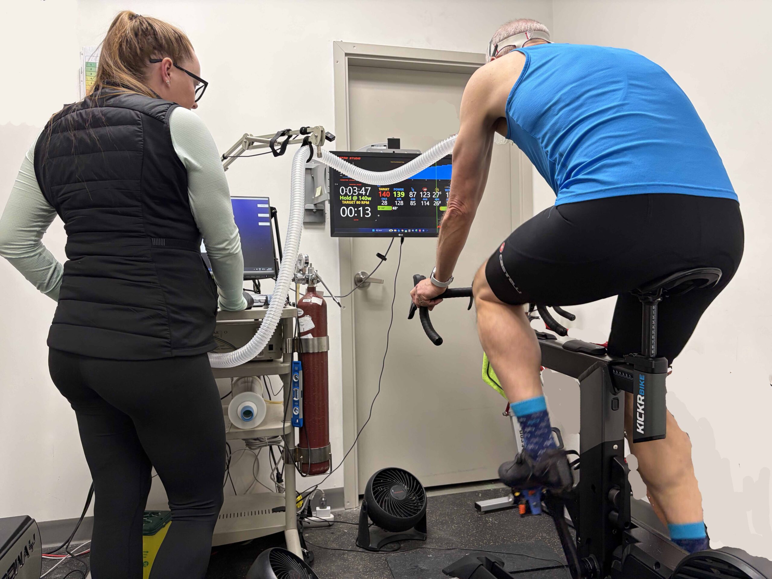
    Initially though, I was introduced to Jessica, a highly qualified exercise physiology assessor who was going to run me through the process over the next ninety minutes. The step test itself would take only a small part of that total time as first she needed to weigh me, measure my height and take my blood pressure.   I seemed to have lost a centimetre, gained a kilogram and have slightly elevated blood pressure! Of the three measurements, only weight was relevant to VO2 Max as the results would be read per kilogram.  

    Gentle warm up without the mask fitted

    Did I know what VO2 Max was and what it signified?  I admitted to being a bit vague but was aware that supermen like Pogačar had figures like 80+ of what whatever units were.    I learned that VO2 max was the volume of Oxygen my body could usefully use to generate energy per minute and this value was rated against my overall mass.  The heavier I was, the lower that figure would be.  So, what did the value actually inform me?  Essentially, how fit I was for aerobic activity.   

    Now, I was not born a natural endurance athlete.  In high school cross-country running, I came home in the bottom 10% even though I could sprint well. Anything over 200m was a nightmare to me.   I could hike and cycle long distances but it was only as I aged, that I managed to train myself to run longer distances and to cycle faster. Had my VO2 Max been higher as a youth I am sure I would have pursued competitive sport for longer. Consequently, I was keen to discover how my endurance fitness now compared with that of my cohort, 50 years later.

    Before commencing the measured test, Jessica got me to put on the heart rate chest strap and shoes and sit on the saddle so she could adjust the test machine for my dimensions.  After some finessing, I was satisfied with the set up and followed a gentle warm up program without wearing the mask.  I rode at 40% and steadily up to 70% of my current Functional Threshold Power (FTP).   It was a comfortable pace at 80 to 90 RPM pedal cadence so I was able to chat with Jessica about my future rides and plans for the year.

    Jessica fits me with he mask

    With the warm up complete, I got off the bike while Jessica selected a standard size mask and fitted the straps so it was tight to my face. Had I been running on a treadmill it would have been even tighter because of the bounce from running. As it was, I knew this new piece of equipment would bug me the most. There was very little resistance to breathing but occasionally the inlet valve would whistle gently so it sounded like I was wheezing.

    Once I was seated back on the test bike,   Jessica connected my mask to a clear pipe that looked like a skinny vacuum cleaner hose.  The screen in front of me counted down to a big green GO sign and I began pedalling at 50% of my assumed FTP for two minutes.  I aimed to keep my pedalling RPM at around 85 and didn’t initially pay much attention to the other figures displayed.  At two minutes, the resistance increased by 20 Watts and I maintained around 85 PRM.  This was like the ERG mode on a smart bike trainer where the force required to turn the pedals will increase if the cyclist reduces the pedalling rate,  or reduce if the cyclist pedals faster.

    By the third 20-Watt step, I was beginning to focus on the figure for my heart rate as it climbed.   I was still reasonably comfortable but becoming more conscious of the mask.  Ten minutes in and we reached my FTP so I was working hard and it was impossible to talk; I just acknowledged Jessica with a nod or thumb raise. Jessica’s gentle coaching had little persuasive impact on me as I had been conditioned in high school and the military by barking male coaches.

    Jessica coaxes me through the early steps in the test

    As my breathing rate increased, I was even more aware of the mask and found there was nowhere for snot and spit to go but down the tube.  Normally a wipe with my towel would suffice. The steps were only a minute long after 220W and I was ok up to 260W when I  noticed my heart rate was already over 150BPM which for me was quite high.  We clicked up to 280W and I was starting to have trouble keeping the RPM high enough – in the low 80s.  I was  tempted to grind out the power at a lower RPM but  I was struggling to breathe fast enough.

    With seconds ticking by in the 280W minute, my heart rate hit 153 and I really wanted that mask off my face.  I knew when I reached the 300W step, I would not get through the next minute.  I wasn’t exactly panicking but, psychologically, I felt the mask was the cause of my breathing issues, and didn’t realize it was simply because I couldn’t breathe fast enough at that level of effort.  At the 300W step I made the cut gesture to Jessica but she struggled for several seconds to unclip the mask.

    While it felt good to be free of the mask, my breathing rate didn’t slow immediately as the mask wasn’t really the problem.  Continuing to pedal at low power during the cool down period, I gradually got my breathing and heart rates down and stopped after 7 of the 10 suggested minutes.

    Jessica began to process the results while I climbed off the bike to change into a tracksuit. I felt good as the overall exercise toll on me was relatively low.  Waiting for Jessica, I took the opportunity to peruse the rest of the store and their physiological test facilities. 

    When the results were processed, I was presented with graphs and block diagrams but the figure I was most interested in was at the top of the page – 42.4 ml/kg/min.  Was this what I had expected, she asked?   I said I had hoped for something over 40 which Google had suggested was good for 60+ year olds.     On TCR Lab scale, of Poor, Below Average, Average, Good and Excellent, my figure crept into the low end of the Excellent range.  There was an additional figure for Ventilation in L/min where my figure of 145l/min was rated as Good.

    Jessica processing the output

    We discussed whether I could have pushed further to the 300W step but Jessica showed me the VO2 against power curve which was already flattening suggesting I was at my limit.  Any increase in power after that can only be generated anaerobically.  Interestingly,  the data suggested my true FTP was nearer 210W than the 220W I had been using.  It is possible my own trainer bike set-up is measuring 5% too high as I have not recalibrated the Stages crank power meter for ages.  Even so, from my VO2 Max figures, it looked like I should be able to increase my FTP a further 10 or even 15 %. 

    So, my Training Zones shook out approximately where I had expected.  Recovery was at a power level of 145W or lower at a heart rate of 105 to 109 BPM.  My Aerobic Zone 2 was 146-170W  for a Heart rate of 120 to 130 BPM.  Tempo would be 171 to 200W taking my heart rate from 131 to 138 BPM giving my Threshold of 200 to 220W at a heart rate of 139 to 147 BPM.  Above this, my VO2 Max was 280W, the last level I had completed and this would be at 153 BPM.   These were figures I could now enter to my TrainerRoad and Strava profiles. 

    My Vo2 Max Curve – Asymptotic after about 42 ml/kg/min

    Jessica explained further that I could still improve my respiratory rate. Some of her clients could reach 60 breaths a minute but it was important not to hyperventilate and to take in full breaths each time.  The best way to  gain this improvement was to ride at VO2 max levels for longer periods and practice forcing a high breath rate. Typical training programs only had you riding for 20 seconds or perhaps a minute at VO2 max but if you could ride for 2 minutes say, you would have to force your breathing to keep going.

    We also discussed fueling on the bike, for my Zone 2 continuous riding  power of 146 to 170W, it seemed I would need 54 grams of carbohydrate per hour. Above about 180W, all my fueling was by carbohydrate so any fat burning took place below that level. Jessica thought I should try to raise the % fat burning at each power level but whether this would be through fasted rides, like pre-breakfast or not I would need to investigate further myself.    

    Other data received on Training Zones and nutrition

    Was this a worthwhile experience for the $160 expenditure?  For a trained cyclist, the results give valuable information on your level of fitness compared with other riders and inform, to a certain extent, your strategy and potential to improve further.   I still have some winter fat to burn off before the summer cycling season so my figure might have been higher, but it is not a test you need to undertake more frequently than annually.  I will be monitoring my training zones  more methodically in future though, using heart rate when I don’t have a power meter fitted.

  • The Death of Gore-Tex?

    As an avid hiker and climber in the UK before moving to Canada,  I was an early adopter of Gore-Tex clothing.  When the heavens opened, as it did so often on the British mountains, I was thankful that at last I could remain dry and also warm.  It wasn’t surprising then when I returned to serious long distance cycling I would seek out clothing with Gore-Tex , particularly as I was then living in the soggy Fraser Valley of BC. 

    Like most of those at the start of a wet Gran Fondo, I was clad in Gore-Tex products

    One particular company, Gorewear,  continued to impress me with its wide range of cycling specific attire from glove and overshoes to jackets and caps. Consequently, it was a huge shock to me to receive an email from Gorewear last month announcing they were closing down for good at the end of March 2026.  After stating that they had produced award-winning and world leading weather protection for more than 40 years they simply explained the decision followed: “a difficult review of long-term prospects in a challenging highly competitive landscape”.

    Although that statement suggested the reasons were simply economic, I quickly discovered there were other factors, particularly environmental challenges, that had weakened the company’s status.  I had been oblivious of the growing environmental movement against performance wet weather clothing manufacturers until Gorewear sent me that email.    Gorewear’s parent company W.L. Gore & Associates  would continue making fabrics for other outdoor companies and they hoped the new products would satisfy  the demands of environmentalists. However,  the jury is out on  whether their substitute fabrics will be as durable or as effective as the original.

    Gore’s sales pitch doesn’t mention the materials used to achieve their magic

    When I investigated, I found that the Patagonia company was among the first to acknowledge an environmental issue with their rainwear products in 2015.  They explained they used a Durable Water Repellant (DWR), a chemical on the surface of breathable fabrics that caused water to bead up and disperse moisture so it didn’t make the material soggy.   The inner layer in the fabric with the vapour barrier would not work if the outer surface layer was saturated.  The issue was that the DWRs were so durable they fell in the category of  “forever chemicals”  that would last  for centuries in the environment.  Patagonia and other companies introduced interim measures to remove the more indestructible chemicals from their garments but they still contained perfluoroalkyl substances, known as PFAS.

    Even if companies managed to remove PFAS from the outer layer of clothing, the inner vapour barrier itself contained PFAS too.  PFAS may impact the immune system, increase the risk of some cancers, and affect reproductive and metabolic systems. Initial pleas from manufacturers that their only solution was to produce less-durable products that would have to be replaced more frequently and would still create an environmental issue fell on deaf ears. 

    The social media campaign against Gore-Tex

    The state of  California banned the use of PFAS in fabrics in 2025. Bans in Colorado and New York followed.  France, Japan, Denmark  and New Zealand have introduced their own legislation and more is to come including a more comprehensive ban in Canada.  Interestingly, the rise of PFAS for waterproof clothing in the 1980s coincided with the ban of asbestos for fire-resistant clothing.  At that time, it was feared although it was toxic, asbestos could not be improved on. Eventually though, superior, environmentally-acceptable alternatives like Polybenzimidazole were developed, proving that if you research hard enough you will find a solution.   

    With the perennial demand for waterproof cycling clothing, we can be hopeful that a superior alternative to PFAS will eventually be discovered too.    For now, I am glad I moved to a drier province but I will be treating my Gorewear products with more care until though new materials appear.  

    References:

    Durable Water Repellents: Our DWR Problem – Patagonia Stories

    The problem of forever chemicals and waterproof clothing | Ethical Consumer

    GOREWEAR To Cease Operations – End of the Road for a Pioneering Brand? | GRAN FONDO Cycling Magazine

    Gore shuts down Gorewear apparel line but keeps Gore-Tex alive | Cycling Weekly

    GOREWEAR | Premium Durable Sports Gear for Running & Cycling

    The end of Gore-Tex? – Pique Newsmagazine

    Polymer Fabric Protects Firefighters, Military, and Civilians | NASA Spinoff

  • Ride Like the Wind

    Ride Like the Wind

    On long distance cycle journeys, there are three factors that impact your daily distance and time on the bike;  hills, road surface and wind. The first two you can plan for but the third is a less-predictable variable.  Three days into a ride on the Alaska Highway, I came across a cyclist stopped at the edge of the road, straddling his heavily loaded touring bike  and slumped over the handlebars.  In a thick German accent, the bike-packer muttered: “Its this wind, everywhere this f***ing wind!”  I could offer only sympathy, as he likely hadn’t foreseen this issue when he’d planned his ride back in Europe.

    Riding the Alaska Highway in the Yukon where wind conditions can be challenging

    As much as headwinds may be demoralizing, stretching out the riding hours and draining energy reserves, tailwinds can propel you as effectively as an electric motor.  On the Yellowhead Highway near Vermillion, a prairie wind pushed me along at 40kph for only 120 Watts of effort.  I arrived at my destination that day before the motel had even prepared a room for me.     

    In some cases, wind is more than just a hinderance or aid though.  In March 2017, to celebrate a significant birthday, my twin brother flew to South Africa to take part in the Cape Town Cycle Tour, a massive cycling event with 35,000 participants.   Wind was clearly going to be an issue when they set off, but not long into the ride the entrants were confronted with 100kph gusts. Riders were  blown off their bikes and the decision was made to cancel the event.  It was a bitter disappointment, especially for those like my brother who had flown half way round the world to participate.

    Cape Town Cycle Tour 2017 – Cancelled because of high winds (News.com.au)

    Even though wind, like weather, cannot always be accurately predicted, it does follow general patterns and there are dominant wind directions which may vary with the season or even the time of day in coastal regions. I learned this the hard way riding on the flat fenland in Eastern England.  The wind rose pattern for Calgary determined by Meteoblue is shown in the figure below and this largely conforms with my experience. 

    Westerly and South-Westerly winds dominate here in Calgary

    The dominant wind directions are westerly and southwesterly, a trend all too apparent when you have to fight your way to Cochrane against a Chinook wind in the spring (as in the banner photo).   The westerly to southwesterly Chinooks are most noticeable from November to April or even May. Interestingly, there are occasions when north-northwesterly or opposing south-southeasterly winds dominate.  This I can testify to as these directions align with the Bow Valley downstream of the city and Nose Creek north of the Downtown. Often, I am fighting one of these winds as I make my way along the Bow Valley Trail through Fish  Creek Park  or northwards up the Nose Creek Trail.

    Nowadays, I always check the wind direction and any predicted changes before I set off on a long ride as it may affect my routing.    Until recently, my go-to tool was the free Windfinder app that predicts wind strength and direction at 3-hour intervals throughout the day.  However, occasionally, I found the 3-hour reporting periods were just too long to show rapidly changing weather.

    Garmin 540 with Windfield included as one of the screen fields

    With my new bike computer (Garmin 540),  I discovered I could introduce information from third party apps and display this in a field next to power, speed and distance data.  Consequently, I use Windfield to display relative wind direction and strength in kph.  The wind direction arrow moves as you turn to show which vector you can expect the wind to come from at any given moment in a ride.  While some may question the value of such information, I find it as valuable as knowing how steep and how long a hill climb will be.  I may decide to reroute and take a more sheltered path instead of remaining exposed in the open.    If you need any convincing that wind is valuable data to display, have a look at the following link.  Live Wind and Weather on your Garmin // WindField 🌬️🌧️☀️ – YouTube