Cochrane is a great destination for a bike ride as there are numerous routes to get there and back. From Downtown, the shortest return journey will be almost 100km but this can be halved by starting out from Shane Homes Rocky Ridge YMCA north of Tuscany. For gravel lovers, there are some unpaved roads south of the Bow River running north of Springbank Airport and the Harmony development, or a there is a short section at the eastern terminus of Glenbow Park on the north side of the river. Timewise, your choices range from a 2-hour sprint to a leisurely 5-hour meander. Fortunately, there are several cafes in Cochrane like the Good Earth Coffeehouse at the Quarry where you can take a mid-ride break, especially if you are braving colder weather.
If you were driving to Cochrane from either Downtown or Northwest Calgary, you would opt for the Crowchild Trail, Highway 1A. But Highway 1A is not a choice for cycling out of Downtown, even though it is a legal option. Heavy, fast-moving traffic and multiple on and off ramps make this an unsafe choice, particularly when there are bike trail alternatives. Outside the city boundary west of Tuscany, the road settles down to a steady 4-lane highway with a wide shoulder. For cyclists comfortable with fast moving traffic on their left, this is an option all the way to Cochrane but care needs to be taken if you descend into Cochrane on the highway as you will need to cross lanes to make a left turn into the town at some point. Alternatively, you can turn left at the top of the hill and ride down on the quieter Gleaneagles Drive.

Starting from the YMCA, you can avoid Highway 1A highway completely by following parallel roads and then just cross the 1A at the traffic lights at the top of Cochrane Hill. If you don’t want to climb back up Cochrane Hill from the low point in the town, just turn around at the Highway 1A intersection. This is a favourite evening ride for bike clubs as the return distance is 50 km, easily rideable in 2 hours in an organized group.
There are several ways to reach the YMCA from downtown but my recommendation would be to follow the Bow River Pathway. You can take either the north or south bank of the river on the Pathway but while the flood bank work is being conducted in Sunnyside and Kensington the south side works best. No further west than the Crowchild Trail crossing, you too will need to cross to the north bank as the path to Edworthy Park on the south side is either closed in winter and spring, or closed for repair work. Once the frost- and root-heaved paving is eventually replaced, this may be a good summer/fall alternative again as the wooded scenery makes a pleasant change from the urban scenery of Parkdale.

Once through Shouldice Park, you cross the old railway bridge and follow the Bowness Road through Bowness. Car traffic is well-behaved here and although the bike lane is alongside the road, the bike path always feels safe. Bowness Road swings north and turns into 85 Street that takes you past the iconic Angels Burger restaurant and then you can either turn left at 48 Ave for Bowness Park and cross the river at the west end, or continue over the river and turn left into Baker Park. Your objective is the cycle path that climbs up parallel to the Stoney Trail towards the Tuscany C-Train station.
An alternative route when leaving Shouldice Park is to stay north of the river, climb up 52 Street to Dale Hodges Park and Bowmont Park and then drop down through Baker Park to reach the bike trail on the west side of the Stoney Trail highway. This route is longer and involves climbing a steep hill.

The bike trail parallel to the Stoney Trail highway wends its way up to Tuscany Station where I usually continue up Rocky Ridge Road, past the Mormon Temple to cross Country Hills Boulevard and arrive at the Rocky Ridge YMCA. At this point, you will have cycled 25km and climbed 280metres. There’s no need to include the YMCA if you head more northwesterly from the Tuscany Station and enter Bearspaw where 12 Mile Coulee and Country Hills Boulevard meet.
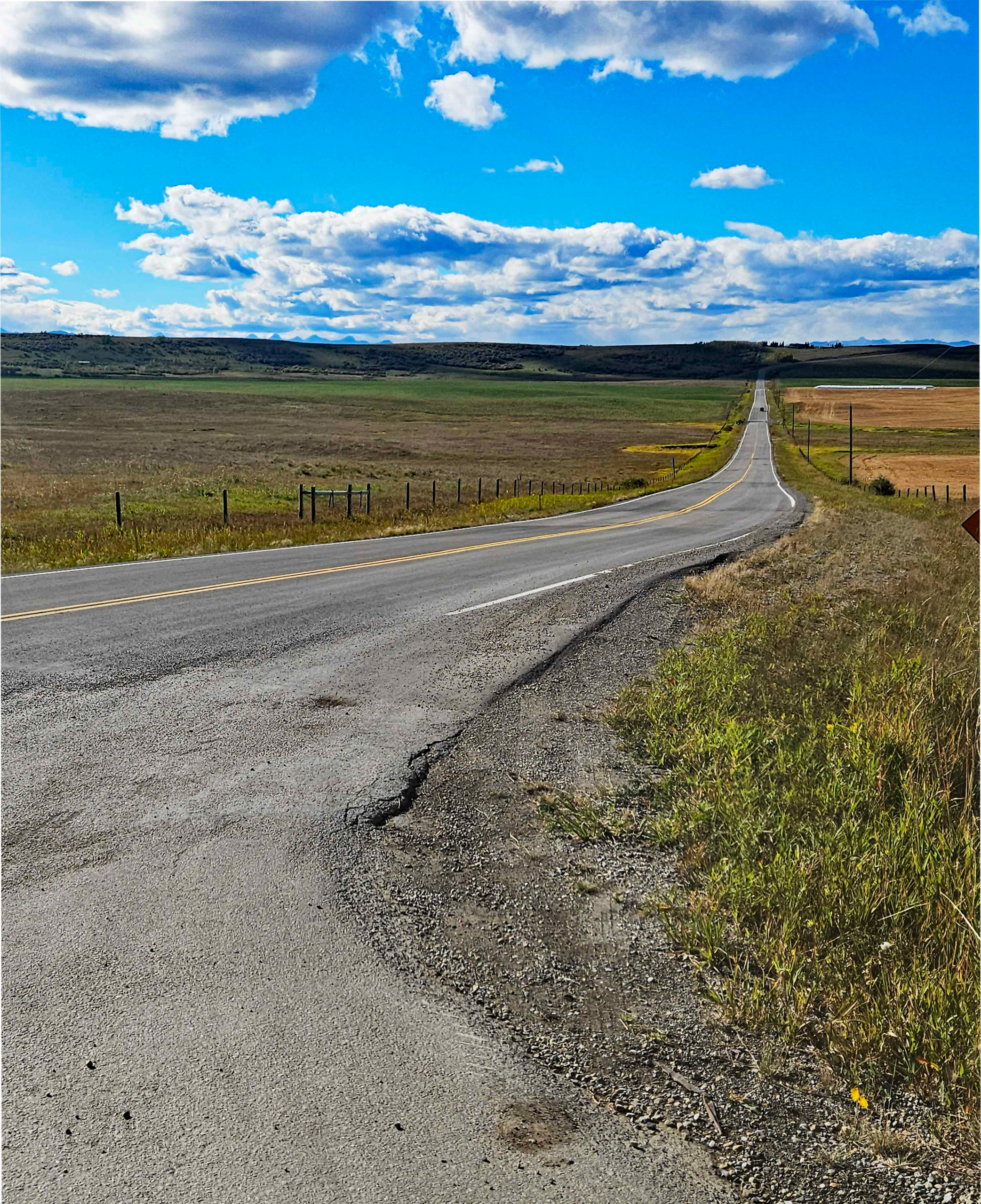
There are several ways to wiggle through the park-like estates at Bearspaw but eventually you will need to take Township Road 262 to the west. You can extend the ride to Cochrane by continuing north on Bearspaw Road as far as Big Hill Springs Road before turning west. Be aware though that Big Hill Springs Road is the Highway 567 link road from Airdrie. This route has freight traffic bound for the Cowboy Trail, Highway 22, the main north-south road into Cochrane. Also, Big Hill Springs Road has little to no shoulder.

The joy with taking this route, though, is that west of the Cowboy Trail you are on quiet country roads and can join up with Horse Creek Road and approach Cochrane from the northwest down the scenic Horse Creek valley. Eventually you join up with the Glen Bole’s Trail that leads you alongside the Bow River and into town. The additional loop adds another 20km to the outbound journey.
South of the Bow River, motorists headed for Cochrane have the option of taking the Trans- Canada Highway, Highway 1 as far west as the Cowboy Trail and then turning north to Cochrane. The Trans-Canada is not a great choice for cyclists, again because of the volume and speed of traffic so you need to consider parallel alternatives. Also, there are no routes out of town between the Trans Canada and the Bow River so, initially, you will need to stay south of Highway 1 or cross the Highway further west.
I have tried four routes, the first climbs out of the Bow Valley on the Quarry Trail under Shaganappi Golf Course. This route follows quiet residential roads and eventually bike paths by the Bow Trail through Strathcona and Wentworth. The route finally exits west on Springbank Road, the Old Banff Coach Road but it is slow with many turns and road crossings and is not one I would recommend. Another route connects up to the Old Banff Coach Road from Edworthy Park but has the same problems as the first route.
The two options I would suggest for a route on the south side of the Bow River involve passing through Bowness and Crestmont. The most direct leaves Bowness up 83 Street and takes the Highway 1 overpass to the Canada Olympic Park. Exit at the west side of the Park onto Crestmont Boulevard and climb up to Crestmont. The other way to Crestmont is to continue onto Bowness Park from Bowness and to climb up the zig-zags under the Stoney Trail bridge.

From Crestmont, you can take the Old Banff Coach Road back over Highway 1 and then ride west past Springbank Airport on Township Road 250, or stay south of the Trans Canada by opting for Township Road 245. This southerly route involves a 300m connector of downhill gravel where care is needed and you will still need to turn north at Calaway amusement park to join Township Road 250. Had you exited the city on Springbank Road, you could have kept riding west until you intersected the Cowboy Trail or turn north past Calaway Park to join Township Road 250.
All westerly roads eventually intersect the Cowboy Trail which you then have to follow north to drop down into Cochrane. The Cowboy Trail is a busy, fast road but has a reasonable shoulder though the only footpath over the Bow River bridge is on the northbound (east) side. The only way of avoiding any riding by the Cowboy Tail still involves crossing the Cowboy Trail to follow a long, looping route to the west with gravel on the Tower Trail.
If you intend to ride gravel to Cochrane, then another parallel route from Crestmont takes you even further north of the Trans-Canada, conveys you behind all the new development at Harmony and the Springbank Airport and brings you out at the Cowboy Trail just before the Cowboy Trails drops down to the Bow River Crossing. A quieter gravel road crosses the river 2km downstream of the Cowboy Trail bridge on the old River Avenue Bridge.

Whichever way you ride out to Cochrane, theres no need to reverse this for the return as you can use one of the other options. The shorter the route selected though the fewer the number of alternatives for returning. However, there should be a choice for everyone, no matter how unsure you are of motor traffic.